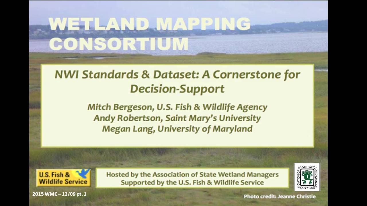
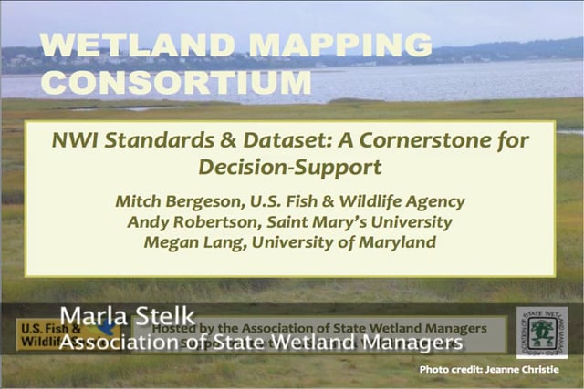
NWI Standards & Dataset: A Cornerstone for Decision-Support
Held Wednesday, December 9, 2015 – 12:00 p.m. ET
INTRODUCTION
- Marla Stelk, Policy Analyst, Association of State Wetland Managers [PRESENTATION PDF]
PRESENTERS
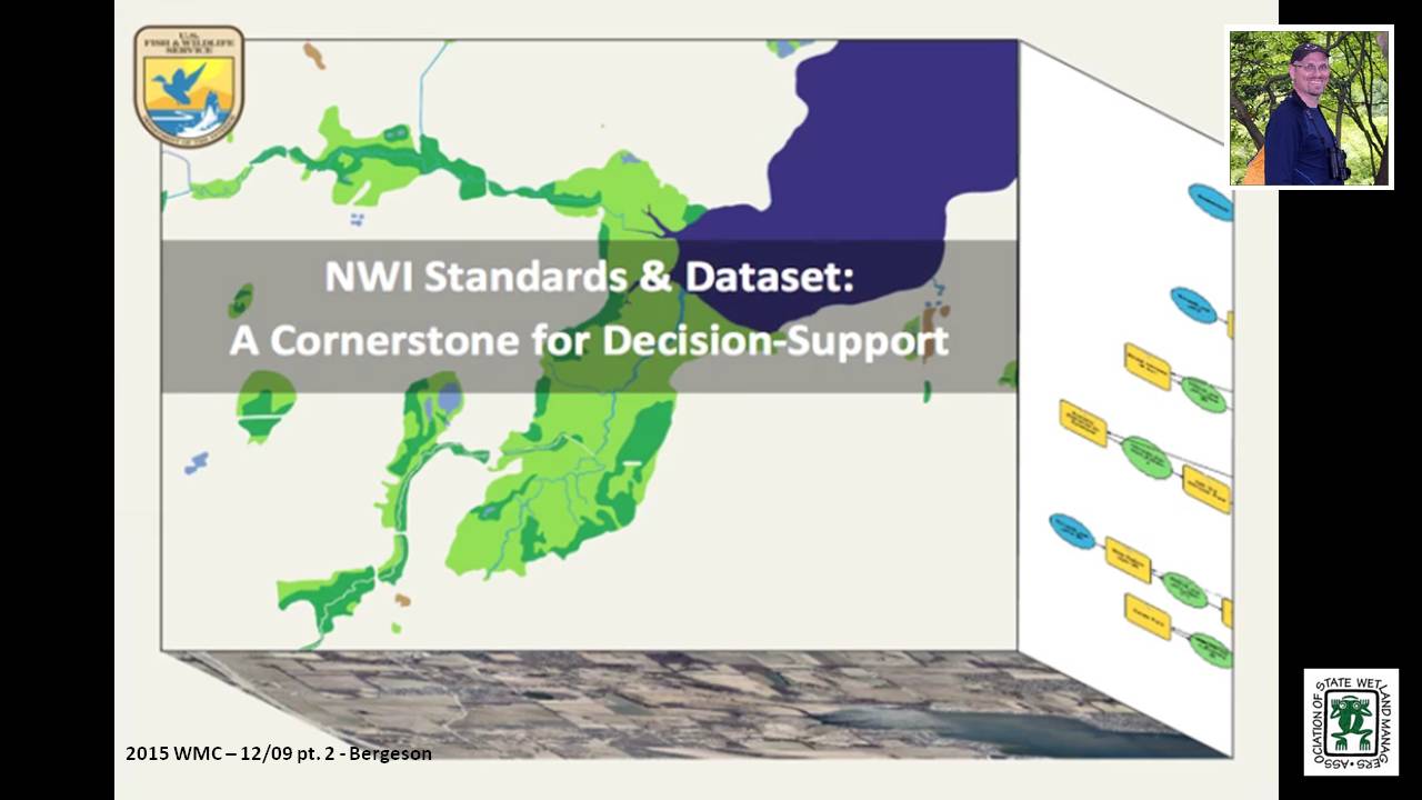
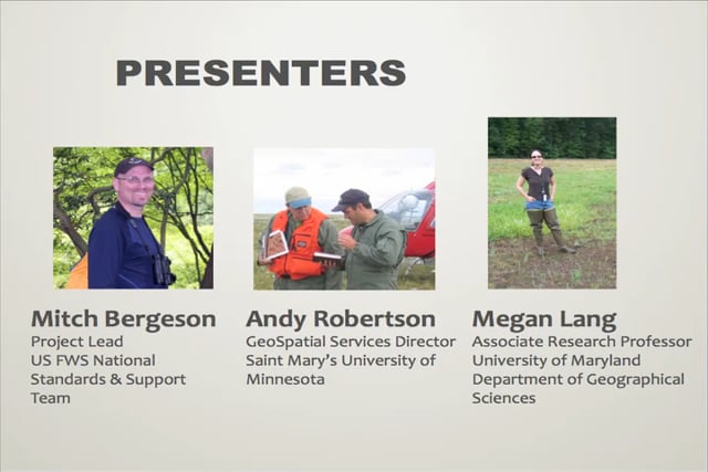
- Mitch Bergeson, U.S. Fish & Wildlife Service [PRESENTATION PDF]
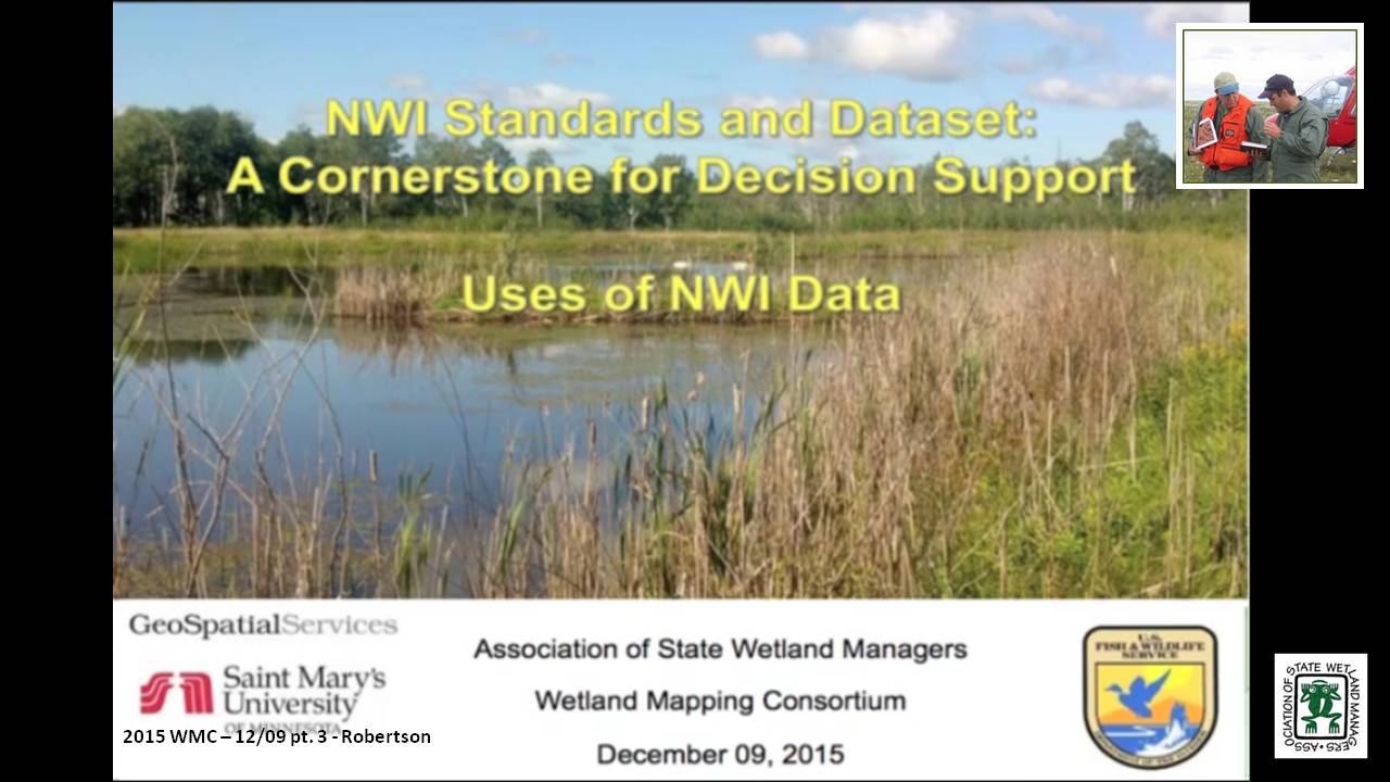
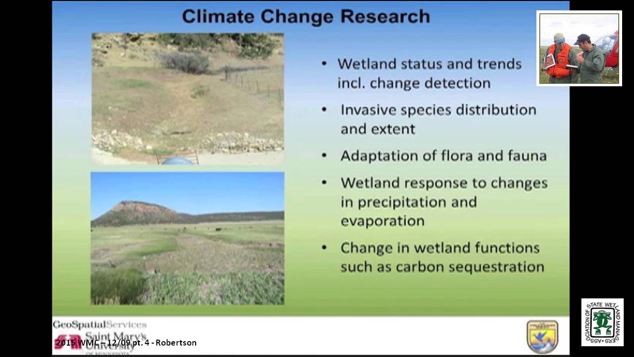
- Andy Robertson, Saint Mary's University [PRESENTATION PDF]
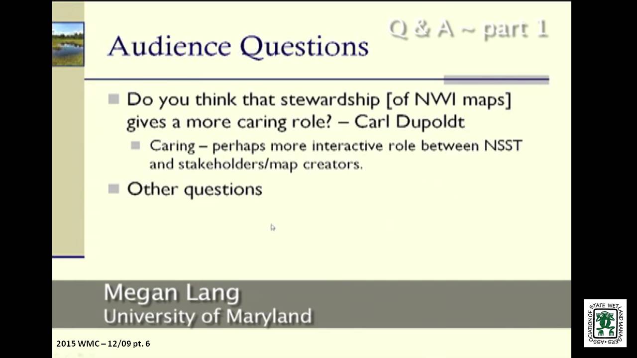
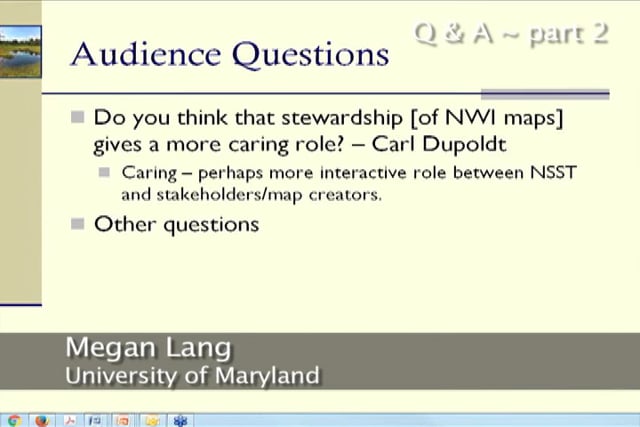
- Megan Lang, University of Maryland [PRESENTATION PDF]
ABSTRACT
The National Wetlands Inventory (NWI) has been and continues to be a primary building block for many mapping projects, and decision support systems. However, the focus of NWI has changed, and the project is now responsible for adding wetland maps developed by third parties (states, nonprofits, etc.) to the NWI dataset, instead of developing original maps. The Federal Geospatial Data Committee Wetlands Mapping Standard must be used in all wetland mapping projects that are funded in part through the federal government. This webinar will inform participants about NWI’s new direction, new Quality Assurance/Quality Control procedures and trends in wetland mapping. Examples of other datasets that have been built up from the NWI layer were presented, and the webinar concluded with a discussion. To ensure that data added to NWI will meet Federal Wetland Mapping Standards and QA/QC requirements, this webinar polled participants about training needs. This information will be used to develop future training webinars.
BIOS
Mitch Bergeson is the Project Lead for the U.S. Fish and Wildlife Service's, National Standards and Support Team (NSST) in Madison WI, which manages the National Wetlands Inventory database, Wetlands Mapper and the Wetlands Status and Trends Projects. Mitch has over 20 years of experience in the natural resource and geospatial fields and holds a B.S. in Biology from the University of Wisconsin - Stevens Point and an M.S. in Wildlife Ecology and Certificate Degree in GIS, both from the University of Wisconsin – Madison.
 After serving as lead Project Manager for over 10 years, Andy Robertson assumed the position of GeoSpatial Services Director on June 01, 2015. In this role, Andy is responsible for oversight and management of all GeoSpatial Services projects, activities and staff. He continues to lead the management of project resources for a wide range of wetland mapping, spatial data development, and natural resource related projects as well as provide supervision and development for technical staff. Andy earned a Forest Technology Diploma from Sault College of Applied Technology in Ontario, Canada, a B.Sc. in Environmental Science from the University of Waterloo and completed post graduate work in forest management at the University of Toronto. GeoSpatial Services has been a key partner of the USFWS and has been working for over 15 years to update legacy National Wetland Inventory data nation-wide.
 Megan Lang is an Associate Research Professor at the University of Maryland Department of Geographical Sciences. She leads the U.S. Department of Agriculture Mid-Atlantic Wetland Conservation Effects Assessment Project, which is focused on assessing the effects of wetland restoration on the provision of ecosystem services. She specializes in characterizing the location and function of wetlands and other aquatic ecosystems through the use of advanced geospatial data and techniques. She places an emphasis on connecting operational needs to actionable data streams, and supporting adaptive management of aquatic systems.
Please click only once on each video recording to view in this window. Part 1: Introduction: Marla Stelk, Policy Analyst, Association of State Wetland Managers![]()
![]()
![]()
![]()
![]()

![]()
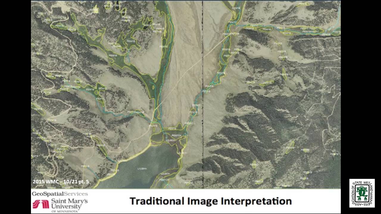
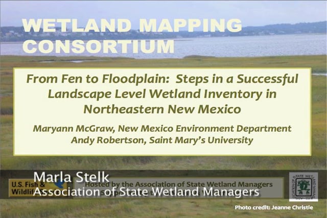
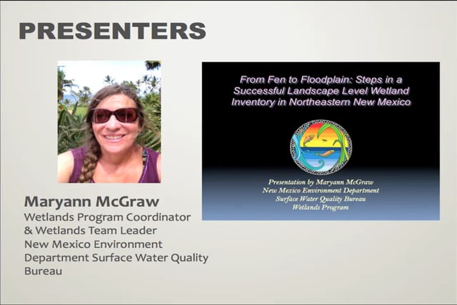
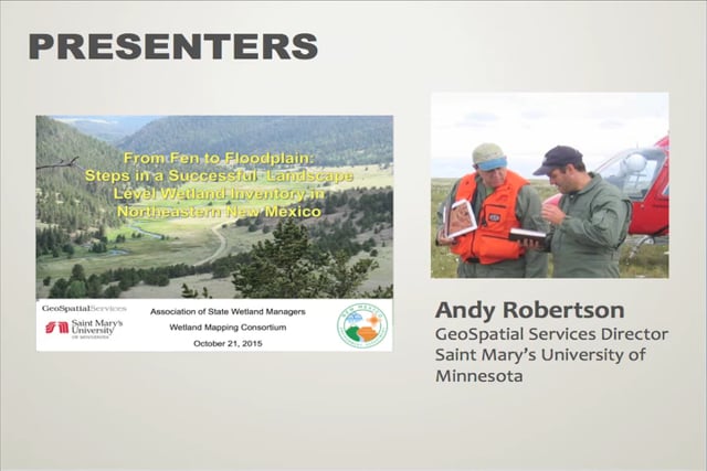
From Fen to Floodplain: Steps in a Successful Landscape Level Wetland Inventory in Northeastern New Mexico
Held Wednesday, October 21, 2015 – 3:00pm ET
INTRODUCTION
- Marla Stelk, Policy Analyst, Association of State Wetland Managers [PRESENTATION PDF]
PRESENTERS
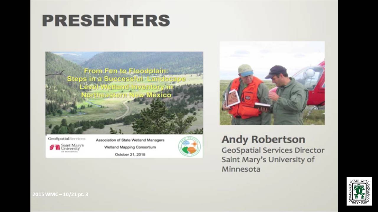
- Andy Robertson, Saint Mary’s University [PRESENTATION PDF]
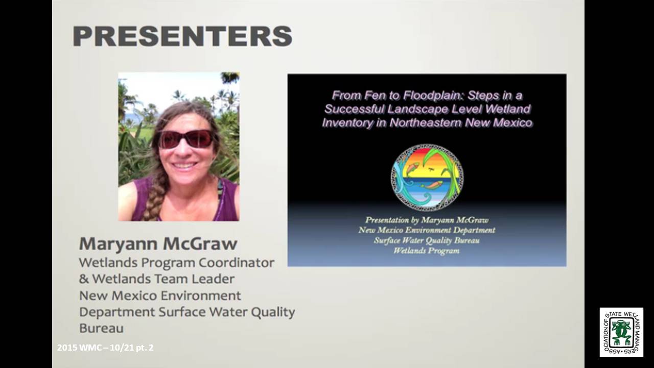
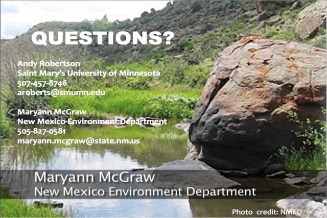
- Maryann McGraw, New Mexico Environment Department [PRESENTATION PDF]
SUMMARY
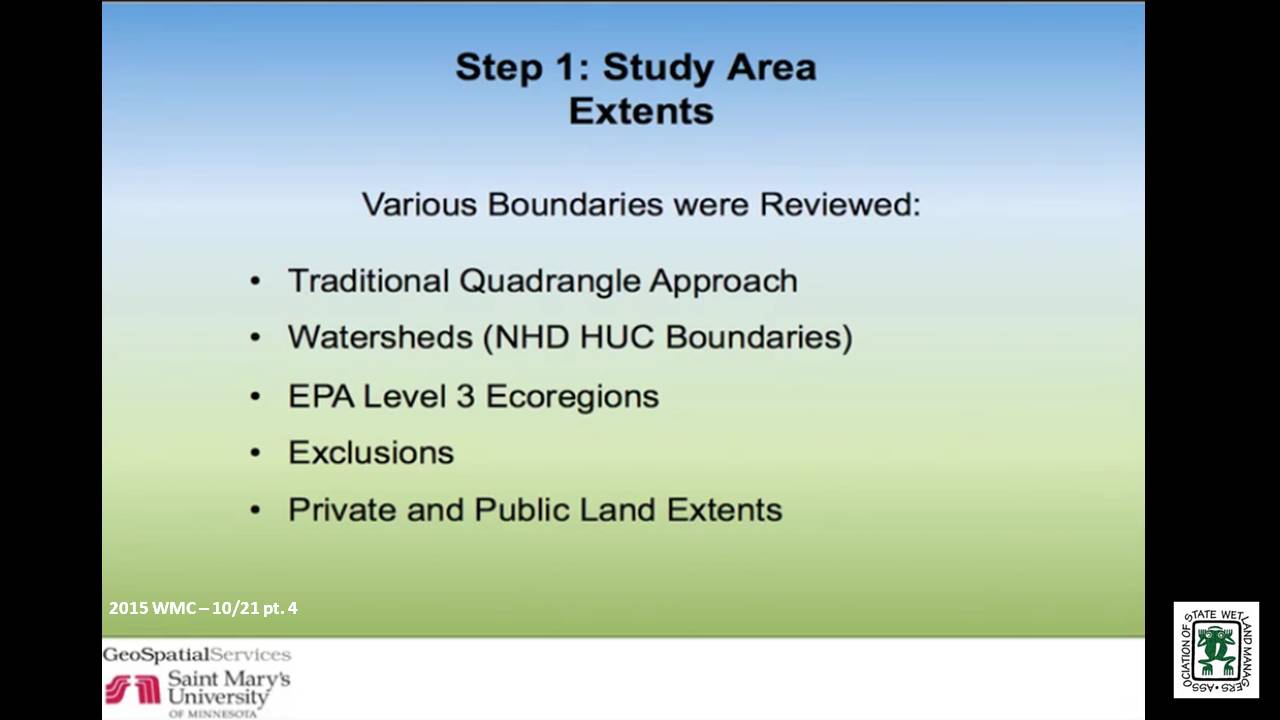
The New Mexico Environment Department (NMED) Surface Water Quality Bureau and Saint Mary’s University of Minnesota GeoSpatial Services (GSS) have recently completed the first National Wetland Inventory mapping project for Northeastern New Mexico’s highlands and plains. This project included the inventory of over 10 million acres of public and private land and resulted in the identification of well over 100,000 wetlands. NMED designed this project specifically to integrate landscape level wetland inventory with the development of the New Mexico wetland Rapid Assessment Methods and site level wetland determinations. As a result, several unique aspects of wetland inventory were developed for this project including: NWI mapping to the FGDC standard; incorporation of additional hydrogeomorphic metrics using LLWW coding; development of a regionally adapted wetland functional assessment; and, design of a crosswalk process (queries and modelling) to assign wetlands to one of several HGM regional sub-classes. In this webinar they examined the various steps that were required to plan and execute a multi-year, area extensive, integrated wetland inventory project across Northeastern New Mexico. The webinar touched on initial planning, project design, integration with other state programs, funding, stakeholder engagement, data development, quality control, inventory enhancements, data delivery and accessibility.
This webinar also included a National Wetlands Inventory Training Needs Assessment. Participants were not only able to learn about this project in New Mexico from start to finish, but they were also able to contribute to the development of four future training webinars. This webinar was uniquely interactive and a great way to make your training needs heard.
 After serving as lead Project Manager for over 10 years, Andy Robertson assumed the position of GeoSpatial Services Director on June 01, 2015. In this role, Andy is responsible for oversight and management of all GeoSpatial Services projects, activities and staff. He continues to lead the management of project resources for a wide range of wetland mapping, spatial data development, and natural resource related projects as well as provide supervision and development for technical staff. Andy earned a Forest Technology Diploma from Sault College of Applied Technology in Ontario, Canada, a B.Sc. in Environmental Science from the University of Waterloo and completed post graduate work in forest management at the University of Toronto. GeoSpatial Services has been a key partner of the USFWS and has been working for over 15 years to update legacy National Wetland Inventory data nation-wide.
 Maryann McGraw is the Wetlands Program Coordinator and the Wetlands Team Leader with the New Mexico Environment Department (NMED) Surface Water Quality Bureau. Maryann has managed the New Mexico Wetlands Program since 2003. The Wetlands Program conducts wetlands mapping and classification, wetlands rapid assessment, develops innovative restoration measures and improves wetlands regulation and water quality standards related to wetlands. Maryann brings the perspective and understands the challenges of a growing Wetlands Program in the arid west. She was awarded the 2010 New Mexico Riparian Council Award for Research, and the Quivira Coalition 2010 Radical Center Award for Civil Service. She has previously taught landscape ecology and restoration classes at Santa Fe Community College including Wetlands, Riparian Restoration, Dryland Restoration, Bioremediation, and Natural History of Arid Lands. Maryann holds Bachelor’s and Master’s Degrees in Geology from the University of Texas at Austin.
Please click only once on each video recording to view in this window. Part 1: Introduction: Marla Stelk, Policy Analyst, Association of State Wetland Managers![]()
![]()
![]()

![]()
![]()

![]()
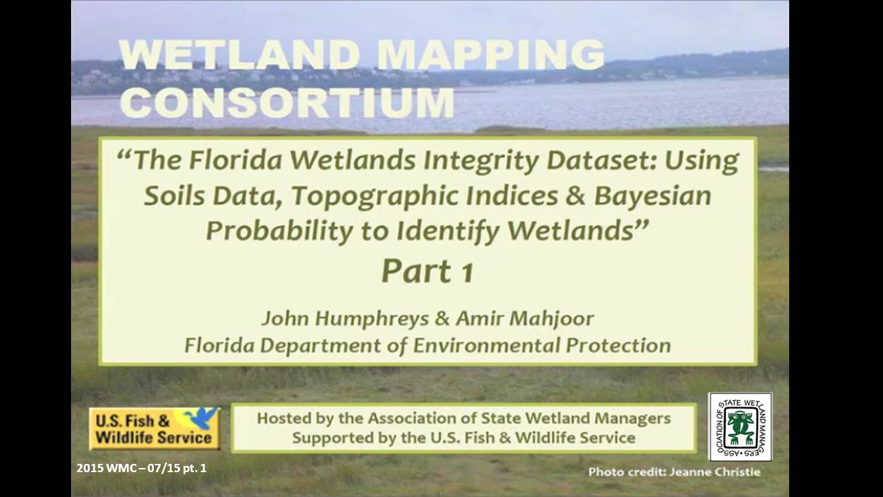
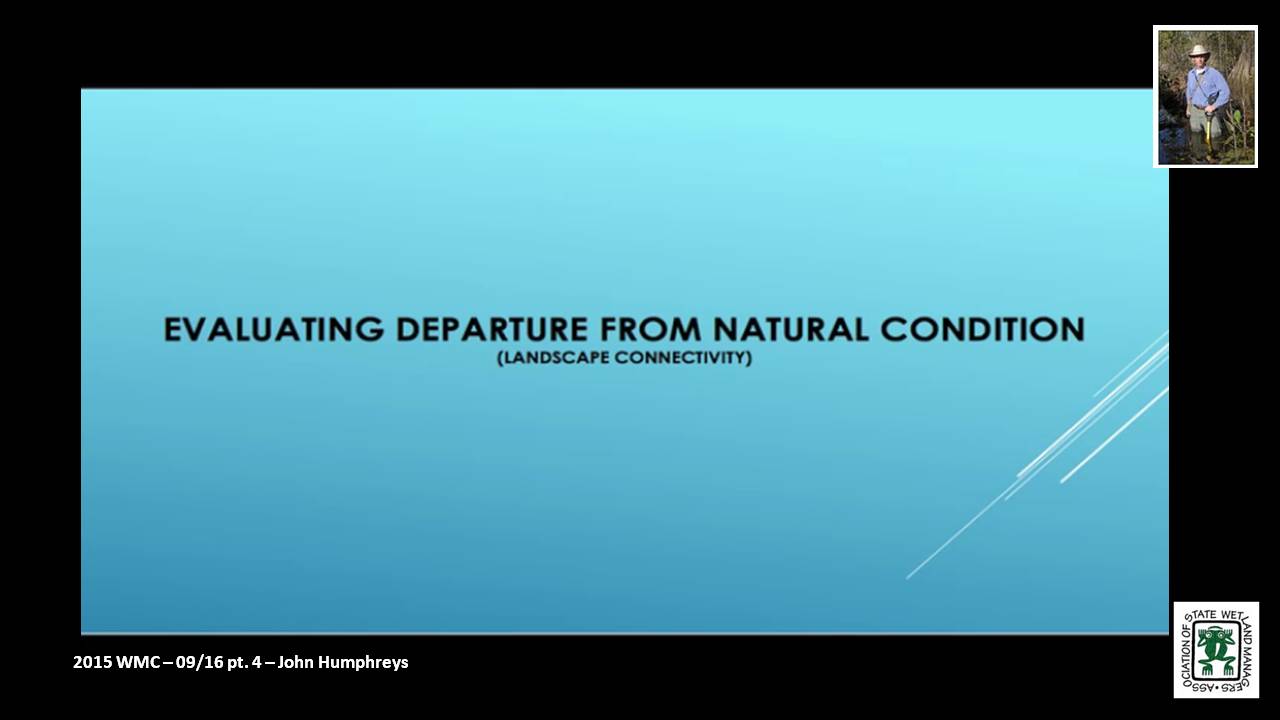
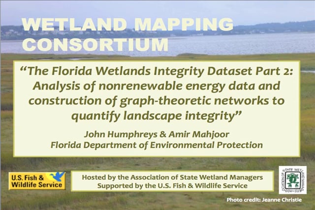
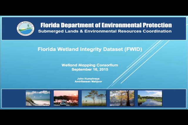
Part 2 – “The Florida Wetlands Integrity Dataset: Analysis of nonrenewable energy data and construction of graph-theoretic networks to quantify landscape integrity”
Held Wednesday, September 16, 2015 - 3:00 p.m.-5:00 p.m. EDT
INTRODUCTION
- Marla Stelk, Policy Analyst, Association of State Wetland Managers [PRESENTATION PDF]
PRESENTERS
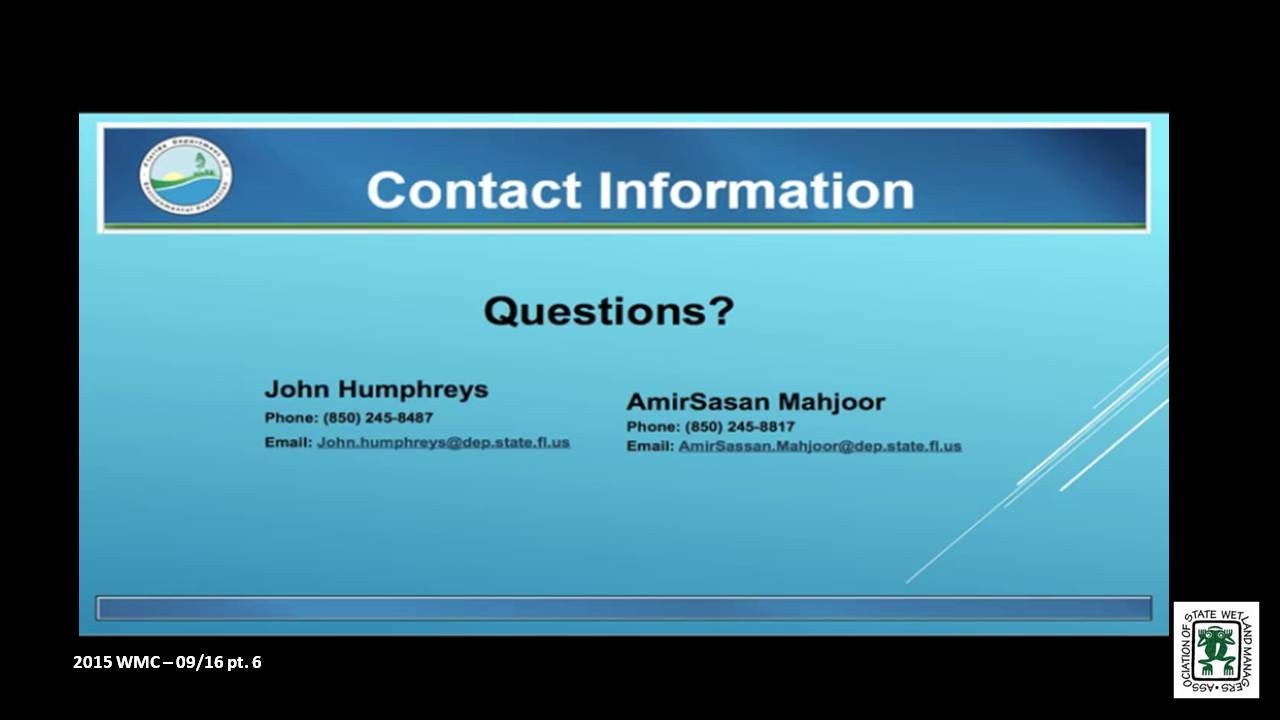
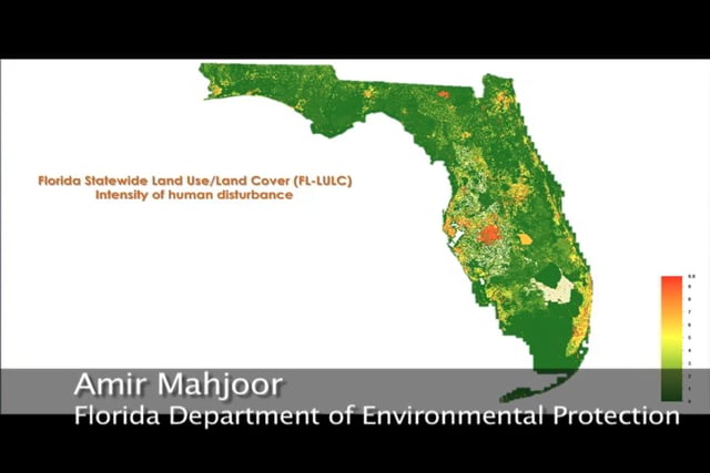
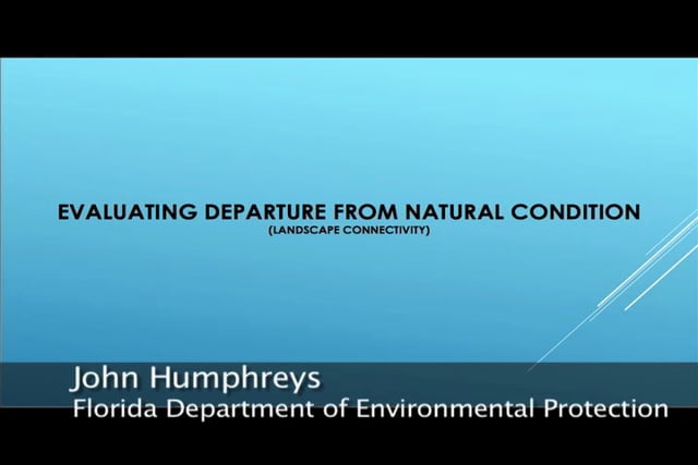
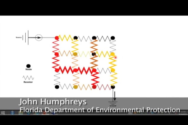
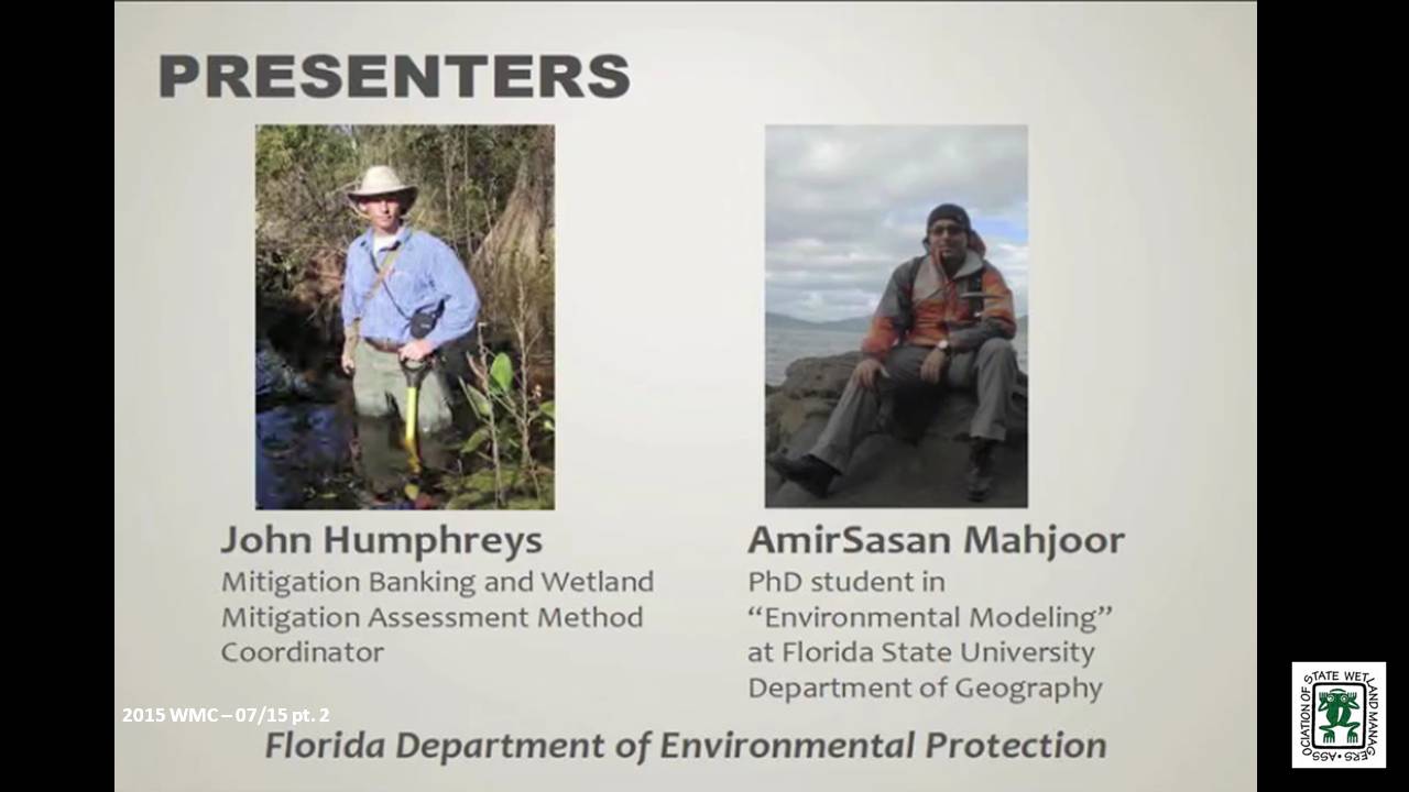
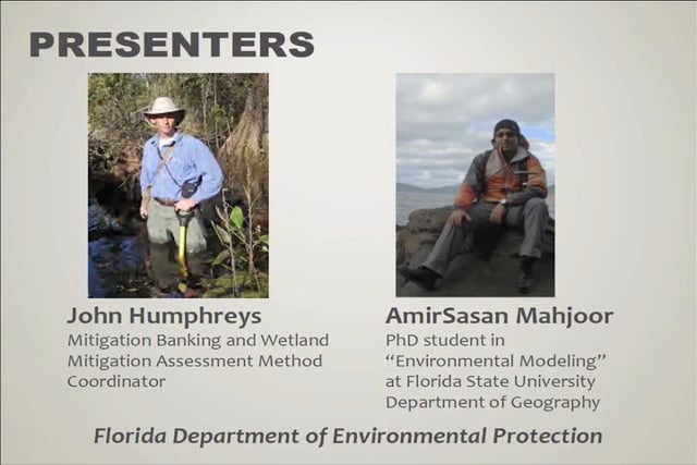
- John Humphreys, Florida Department of Environmental Protection
- Amir Mahjoor, Florida Department of Environmental Protection [PRESENTATION PDF]
PROJECT SYNOPISIS
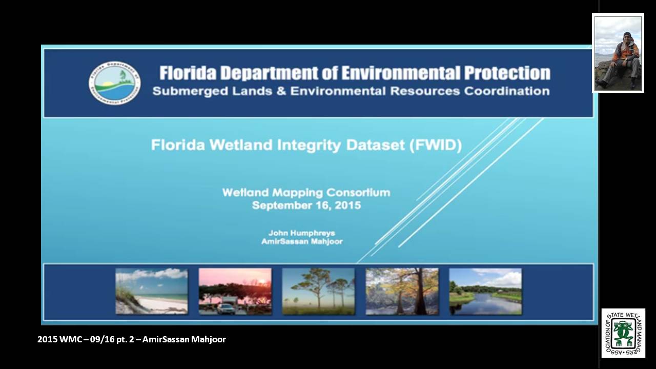
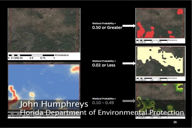
In September of 2013 the Florida Department of Environmental Protection was awarded a three-year EPA Wetland Program Development Grant to develop an ecological model that approximates the extents of wetlands and surface waters for the entire State of Florida. In addition to identification of areal extents, model predicated wetlands are to include a numeric index that corresponds to the predicted quality or “integrity” of each system.
In the second of the two-part webinar series, DEP staff provided an overview of the techniques being used to quantify the “integrity” of Florida’s wetlands. During this talk, staff explained how known associations between landuse and nonrenewable energy consumption can be leveraged to approximate a community’s departure from natural condition and how construction of graph-theoretic networks can be used to identify those natural areas that serve as hubs or conduits for wildlife movement.
BIOS
 John Humphreys is the Department of Environmental Protection’s Mitigation Banking and Wetland Mitigation Assessment Method Coordinator and has statewide responsibility for ensuring coordination and consistency in all aspects of rule development and rule implementation for Chapters 62-342 and 62-345 of the Florida Administrative Code. John holds a bachelor's degree in biology and geology from Kent State University and is currently a graduate student in spatial ecology at Florida State University. Prior to joining the Department in 2008, John was employed with the Florida Fish and Wildlife Conservation Commission and the National Park Service.
 Amirsasan Mahjoor is PhD a student in “Environmental Modeling” at Florida State University Department of Geography. His research interest is socio-ecological system analysis and his main focus is on socio-ecological systems sustainability and integrity analysis. He has completed two master's degree in geology and Geographical Information Sciences (GIS) at Florida State University. Amirsasan has been collaborating with Florida Department of Environmental Protection on developing Florida wetland integrity dataset, since November 2013.
Please click only once on each video recording to view in this window. Part 1: Introduction: Marla Stelk, Policy Analyst, Association of State Wetland Managers![]()
Presenter: John Humphreys, Florida Department of Environmental Protection ![]()
![]()
![]()
![]()
![]()
August – No webinar
![]()
Part 1 - “The Florida Wetlands Integrity Dataset: Using soils data, topographic indices, and Bayesian probability to identify wetlands”
Held Wednesday, July 15, 2015 - 3:00 p.m.-5:00 p.m. EDT
INTRODUCTION
- Marla Stelk, Policy Analyst, Association of State Wetland Managers [PRESENTATION PDF]
PRESENTERS
John Humphreys and Amir Mahjoor, Florida Department of Environmental Protection [PRESENTATION PDF] (For Part 2, see above.)
PROJECT SYNOPSIS
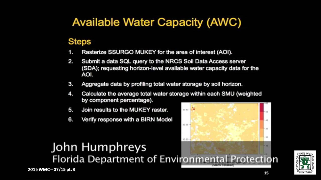
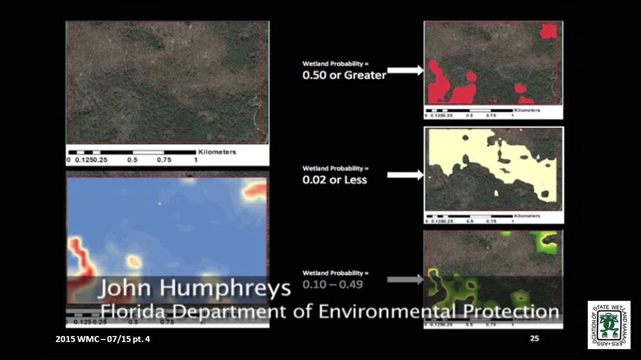
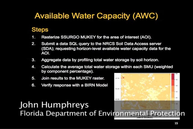
In September of 2013 the Florida Department of Environmental Protection was awarded a three-year EPA Wetland Program Development Grant to develop an ecological model that approximates the extents of wetlands and surface waters for the entire State of Florida. In addition to identification of areal extents, model predicated wetlands are to include a numeric index that corresponds to the predicted quality or “integrity” of each system.
In the first of a two-part webinar series, DEP staff discussed how cutting-edge statistical techniques can be used to identify wetlands probabilistically using NRCS soils data and other ancillary information. The statistical technique they will be discussing has – to the best of their knowledge – never been applied to the task of wetland identification.
BIOS
John Humphreys is the Department of Environmental Protection’s Mitigation Banking and Wetland Mitigation Assessment Method Coordinator and has statewide responsibility for ensuring coordination and consistency in all aspects of rule development and rule implementation for Chapters 62-342 and 62-345 of the Florida Administrative Code. John holds a bachelor's degree in biology and geology from Kent State University and is currently a graduate student in spatial ecology at Florida State University. Prior to joining the Department in 2008, John was employed with the Florida Fish and Wildlife Conservation Commission and the National Park Service.
Part 1: Introduction: Marla Stelk, Policy Analyst, Association of State Wetland ManagersAmirsasan Mahjoor is PhD a student in “Environmental Modeling” at Florida State University Department of Geography. His research interest is socio-ecological system analysis and his main focus is on socio-ecological systems sustainability and integrity analysis. He has completed two master's degree in geology and Geographical Information Sciences (GIS) at Florida State University. Amirsasan has been collaborating with Florida Department of Environmental Protection on developing Florida wetland integrity dataset, since November 2013.
Please click only once on each video recording to view in this window.![]()
Presenter: John Humphreys, Florida Department of Environmental Protection![]()
![]()
![]()
![]()
![]()
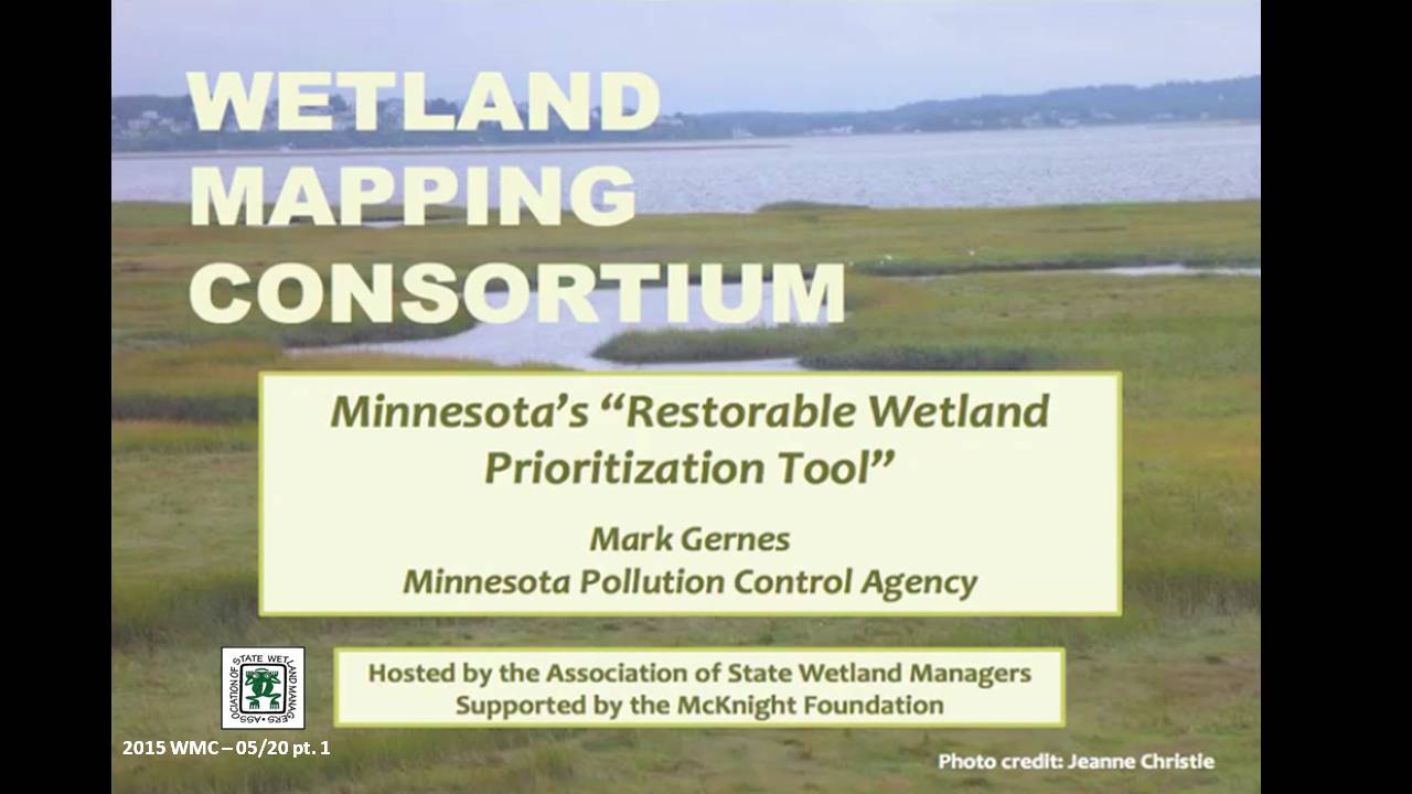
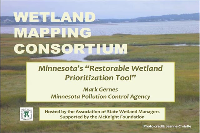
Minnesota's "Restorable Wetland Prioritization Tool"
Held Wednesday, May 20, 2015 - 3:30 p.m. ET
INTRODUCTION
- Marla Stelk, Policy Analyst, Association of State Wetland Managers [PRESENTATION PDF]
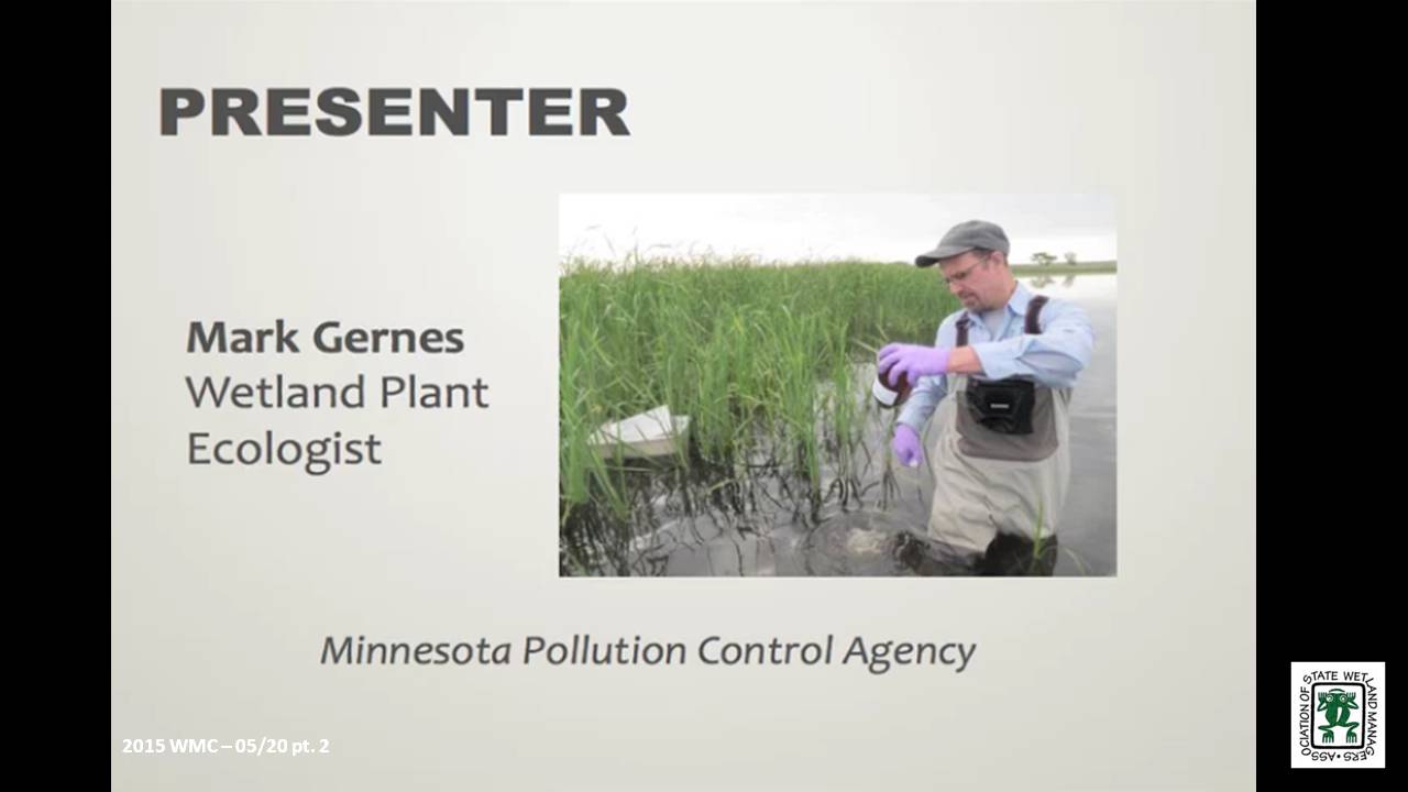
PRESENTER
- Mark Gernes, Minnesota Pollution Control Agency [PRESENTATION PDF]
ABSTRACT
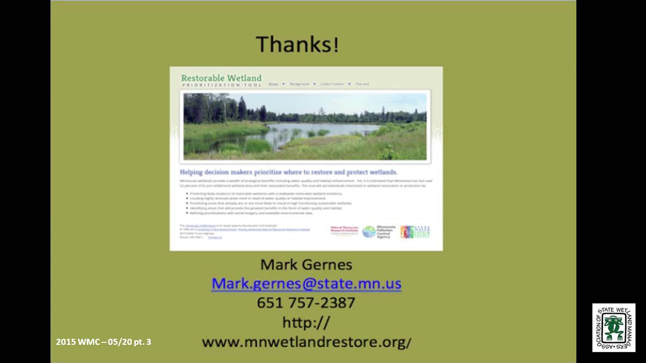
Helping decision makers prioritize where to restore and protect wetlands is the purpose of Minnesota’s GIS driven “Restorable Wetland Prioritization Tool.” This online tool helps maximize water quality benefits and funding by:
- Predicting likely locations of restorable wetlands with a statewide restorable wetland inventory.
- Locating highly stressed areas most in need of water quality or habitat improvement.
- Prioritizing areas that have the potential to be, or currently are, high functioning sustainable wetlands.
- Identifying areas with the greatest benefits in the form of water quality and habitat.
- Refining prioritizations with aerial imagery and available environmental data.
This tool was developed for use in Minnesota in 2013, and Mark Gernes, a Wetland Plant Ecologist at the Minnesota Pollution Control Agency, discussed how the tool was developed, how it has been used, and what has worked and/or has not worked well, offering suggestions for other states interested in developing their own tools.
BIO
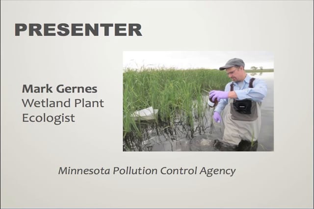
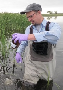 Mark Gernes works as a Wetland Plant Ecologist at the Minnesota Pollution Control Agency. Since 1992 his work has focused on wetland policy issues and researching wetland responses to environmental stress from chemical pollution, invasive species and habitat alterations including water level changes. He is also engaged in work to prioritize wetland restoration siting in Minnesota to benefit water quality. Mark’s statewide wetland responsibilities include monitoring and reporting on trends in wetland quality and watershed technical assistance to several MPCA programs. Mark earned a Master’s degree in Biological Science, with emphasis in Plant Ecology from St. Cloud State University and Bachelors in Biological Science from Bemidji State University in Northern Minnesota. Mark is married and father to two adult children. He enjoys reading, native landscaping, gardening, making maple syrup and is an avid outdoorsperson.
Part 1: Introduction: Marla Stelk, Policy Analyst, Association of State Wetland Managers
Please click only once on each video recording to view in this window.![]()
Presenter: Mark Gernes, Minnesota Pollution Control Agency![]()
![]()
![]()
![]()

![]() April – No webinar
April – No webinar
![]()
WMC Workshop: "Accessing, Analyzing and Communicating Digial Wetland Data to Stakeholders for Decision-making"
Held at ASWM Winter Meeting Workshop, March 24-26, 2015
INTRODUCTION
- Marla Stelk, Policy Analyst, Association of State Wetland Managers
PRESENTERS
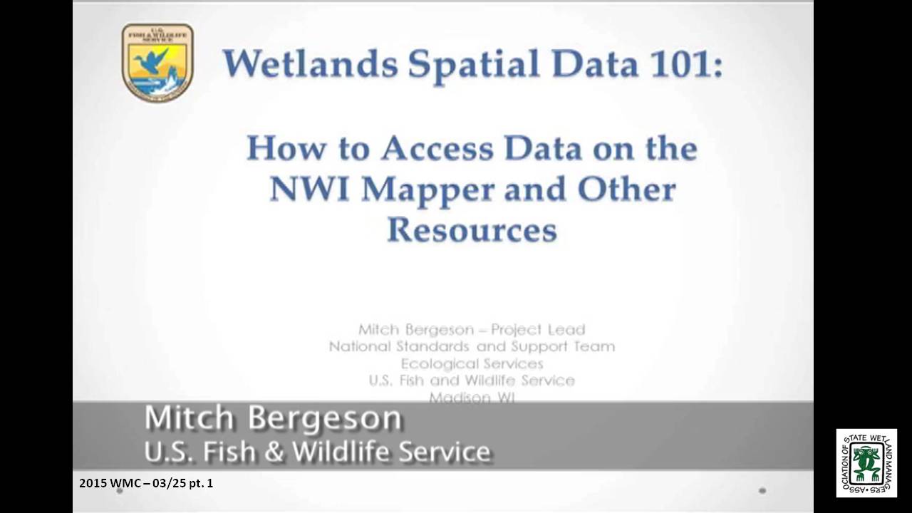
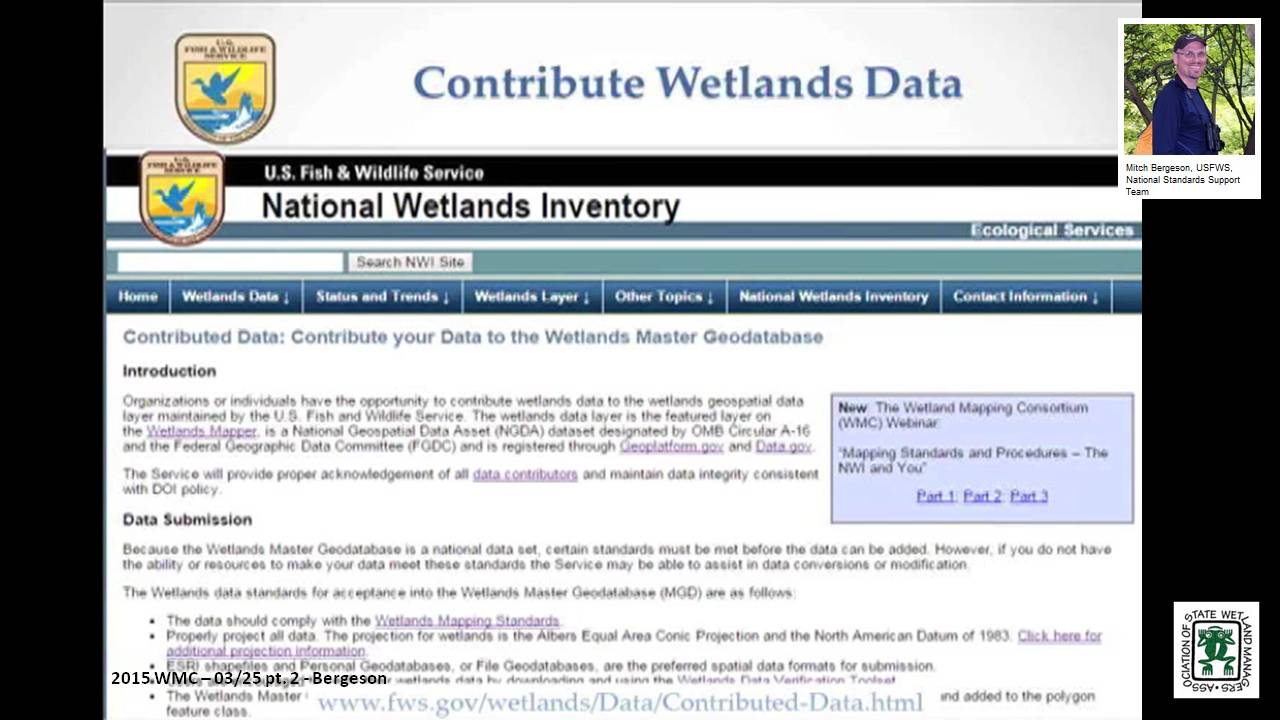
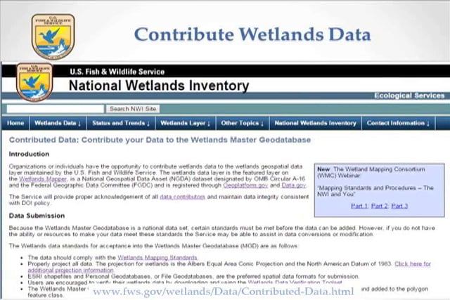
1:30 p.m.-2:00 p.m. Wetlands Spatial Data 101: How to Access Data on NWI Mapper and Other Resources – Mitch Bergeson, USFWS, National Standards Support Team
2:00 p.m.-2:30 p.m. Communicating Digital Wetland Data to Stakeholders: What to do With the Data Once You Have It – Andy Robertson, Saint Mary's University
2:30 p.m.-3:00 p.m. Available Wetland Data for Analysis at Different Spatial and Temporal Scales – Megan Lang, University of Maryland and Nate Herold, NOAA Coastal Services Center
 Mitch Bergeson is a GIS Specialist for the US Fish and Wildlife Service's, National Standards and Support Team in Madison WI. He is the Project Lead for the National Wetlands Inventory database, Wetlands Mapper and the Wetlands Status and Trends Projects. Mitch has over 20 years of experience in the natural resource and geospatial fields and holds a B.S. in Biology from the University of Wisconsin - Stevens Point and an M.S. in Wildlife Ecology and Certificate Degree in GIS, both from the University of Wisconsin – Madison.
 Andy Robertson joined Saint Mary’s University as GeoSpatial Services Project Manager in 2004. In this current position, he is responsible for the management of project resources for a wide range of wetland inventory, spatial data development and natural resource related projects. Andy has over 25 years of natural resource project management experience with both the public and private sectors and as a consultant. Andy earned a Forest Technology Diploma from Sault College of Applied Technology in Ontario, Canada, a B.S in Environmental Science from the University of Waterloo and completed post graduate work at the University of Toronto. Andy is a Registered Professional Forest Technologist and a member of both the Canadian Institute of Forestry and the Society of American Foresters.
 Megan Lang is a Research Associate Professor at the University of Maryland Department of Geographical Sciences. She leads the U.S. Department of Agriculture Mid-Atlantic Wetland Conservation Effects Assessment Project, which is focused on assessing the effects of wetland restoration on the provision of ecosystem services. She specializes in characterizing the location and function of wetlands and streams and interactions between aquatic ecosystems through the use of advanced geospatial data and techniques. She places an emphasis on connecting operational needs to actionable data streams, and supporting adaptive management of aquatic systems. Megan is co-founder of the U.S. Association of State Wetland Managers Wetland Mapping Consortium and has helped to develop wetland monitoring strategies for the state of Maryland and the United States.
 Nate Herold is with the Geospatial Solutions Program at the National Oceanic and Atmospheric Administration's Coastal Services Center (CSC) in Charleston, SC where he leads up the NOAA’s land cover mapping activities, managing the Coastal Change Analysis Program (C-CAP). C-CAP is a nationally standardized database of land cover and change information developed for the Nation’s coastal regions. These products are developed utilizing remotely sensed imagery and can be used to track changes in the landscape through time. Nate came to the NOAA after several years working in the private sector, where he was involved in the production of land cover products worldwide. He has a Bachelors in Soil Science, from Penn State University; and Masters in Geography, from George Mason University.
Part 1: Introduction: Marla Stelk, Policy Analyst, Association of State Wetland Managers
Please click only once on each video recording to view in this window.![]()
Presenter: Mitch Bergeson, USFWS, National Standards Support Team![]()
![]()
![]()
![]()

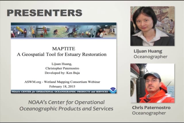
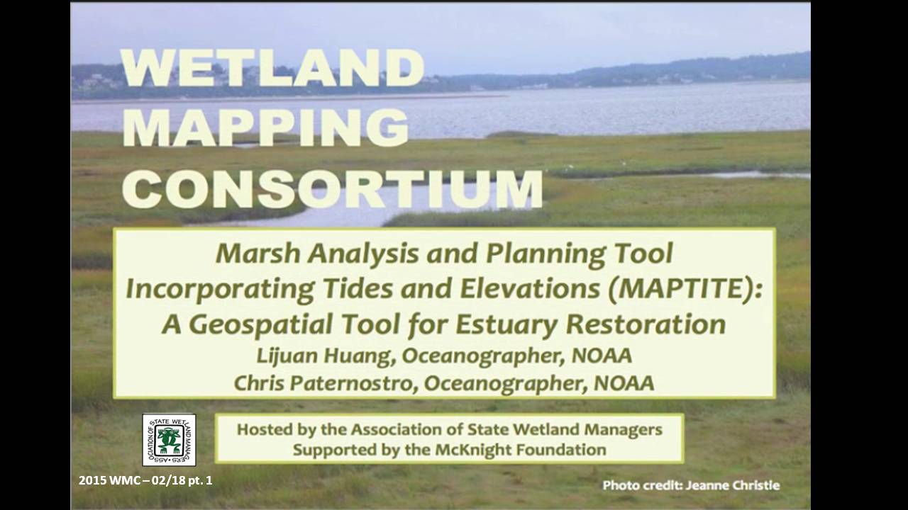
![]() Marsh Analysis and Planning Tool Incorporating Tides and Elevations (MAPTITE): A Geospatial Tool for Estuary Restoration
Marsh Analysis and Planning Tool Incorporating Tides and Elevations (MAPTITE): A Geospatial Tool for Estuary Restoration
Held Wednesday, February 18, 2015 – 3:00 p.m. EST
INTRODUCTION
- Marla Stelk, Policy Analyst, Association of State Wetland Managers [PRESENTATION PDF]
PRESENTERS
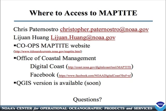
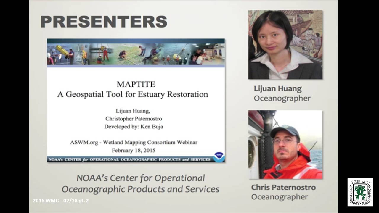
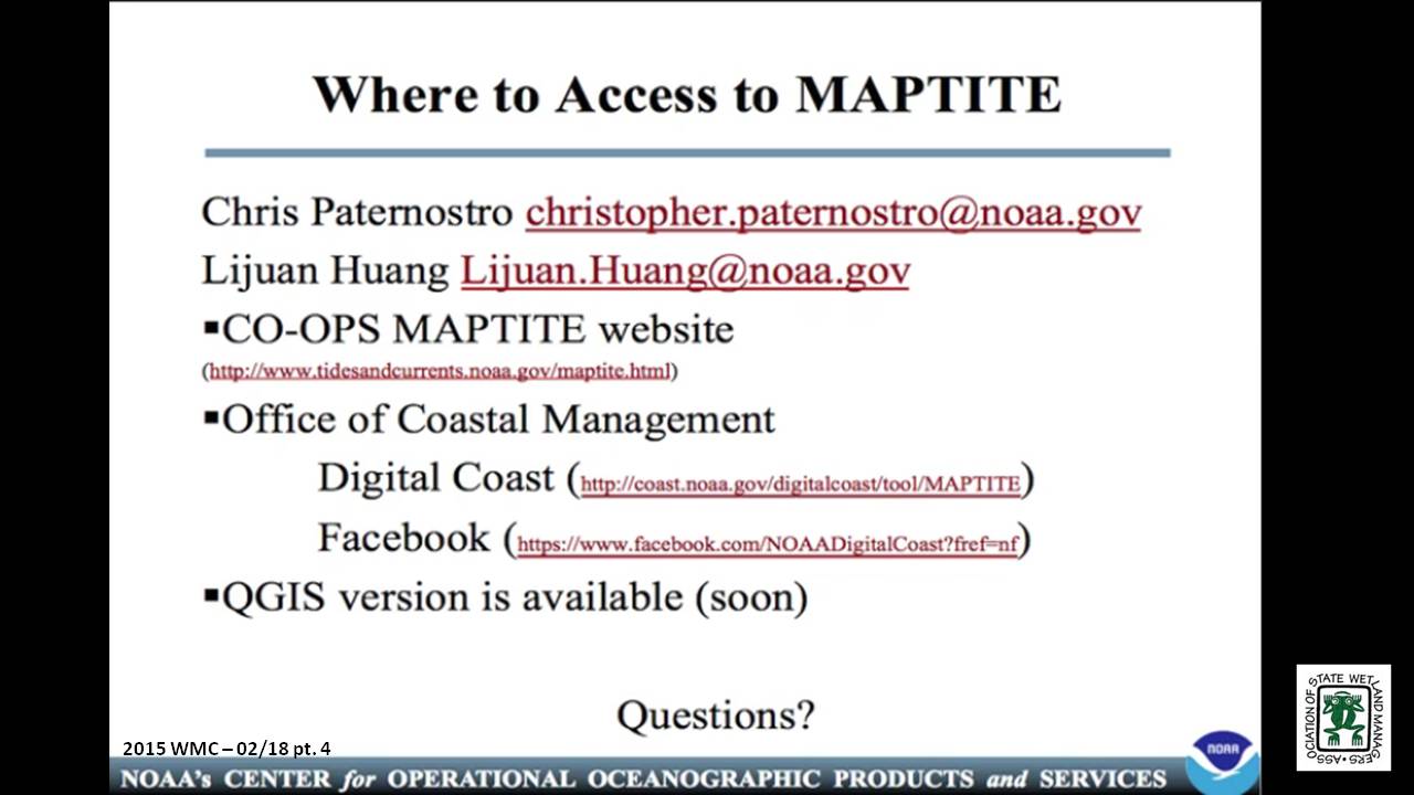
- Lijuan Huang, NOAA [PRESENTATION PDF]
- Chris Paternostro, NOAA
ABSTRACT
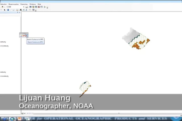
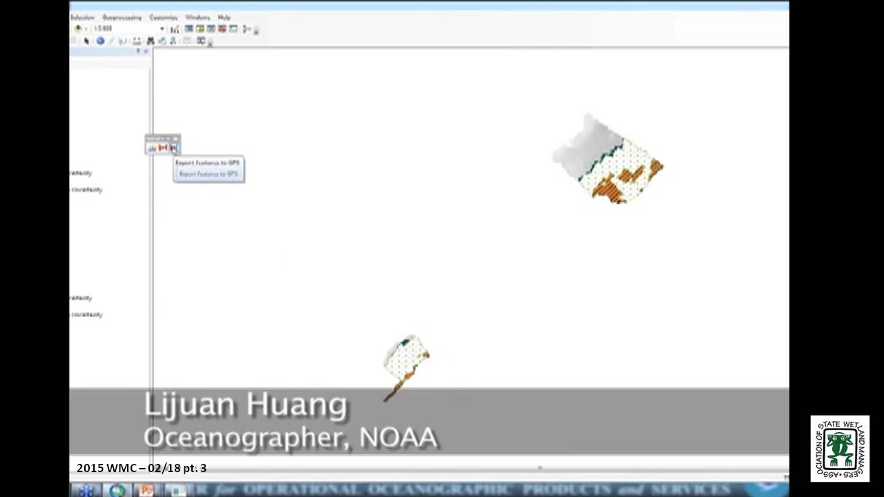
As understanding has grown of the critical part wetlands play in the health of the world’s oceans and how they act as protective, productive buffers against wave action and storms; so has the awareness of a critical need to both protect remaining wetlands and to begin a focused and coordinated effort to restore lost wetlands. NOAA’s Center for Operational Oceanographic Products and Services (CO-OPS), partnering with other NOAA offices, USACE and the National Aquarium in Baltimore, developed Marsh Analysis and Planning Tool Incorporating Tides and Elevations (MAPTITE) for coastal restoration planning. MAPTITE is based on the premise that wetland plant communities are organized by their various tolerances to environmental stresses brought upon by periodic inundation and salinity intrusion. This geospatial tool takes advantage of this relationship to model specific plant communities given a measured elevation gradient at a coastal wetland restoration or creation site. It provides a ESRI ArcGIS extension that aids in the selection of vegetation types for different restoration elevations determined by a combination of a digital elevation model (DEM) derived from GPS observations, local tidal datums, and wetland vegetation information. By delineating planting areas and providing point data that can be uploaded to GPS receivers for those areas, MAPTITE allows users to accurately plant appropriate species during restoration, promoting growth of native species in order to successfully create or restore ecosystem functions of the marsh. The tool addresses a need of government, academic and coastal manager communities for coastal restoration planning.
 Lijuan Huang has been with NOAA as an oceanographer for 9 years. She is an expert on the navigational and non-navigational applications of tide data. She holds a M.S. in Geological Oceanography from the Marine Science Research Center of Stony Brook University School, NY and a B.S. in Physical Oceanography from Xiamen University in China.
 Chris Paternostro is an internationally acclaimed expert on tides and currents, currently employed by the National Oceanic & Atmospheric Administration (NOAA). He is a computational oceanographer who has developed many systems for analyzing and displaying oceanographic data. He is the lead of the Coastal & Estuarine Circulation Analysis Team.
Please click only once on each video recording to view in this window.

Part 1: Introduction: Marla Stelk, Policy Analyst, Association of State Wetland Managers
Presenter: Chris Paternostro, NOAA
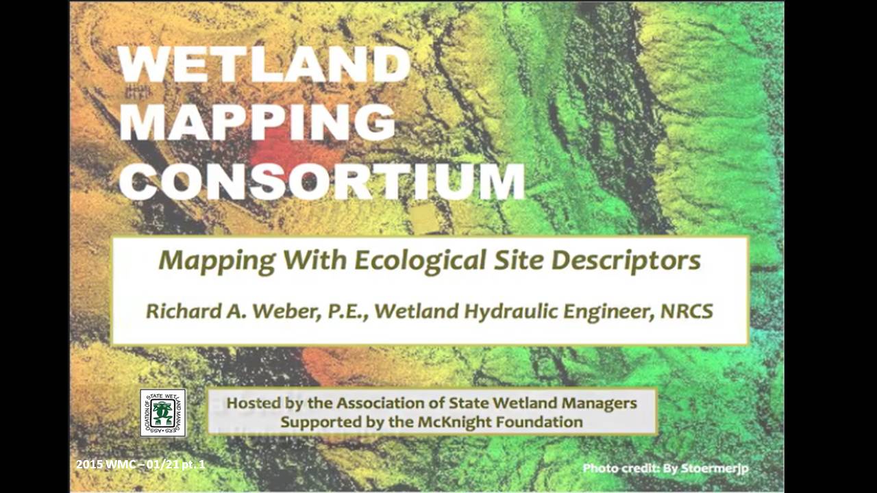
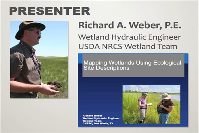
![]() Mapping with Ecological Site Descriptors
Mapping with Ecological Site Descriptors
Held Wednesday, January 21, 2015 – 3:00 p.m. EST
INTRODUCTION
- Marla Stelk, Policy Analyst, Association of State Wetland Managers [PRESENTATION PDF]
PRESENTER
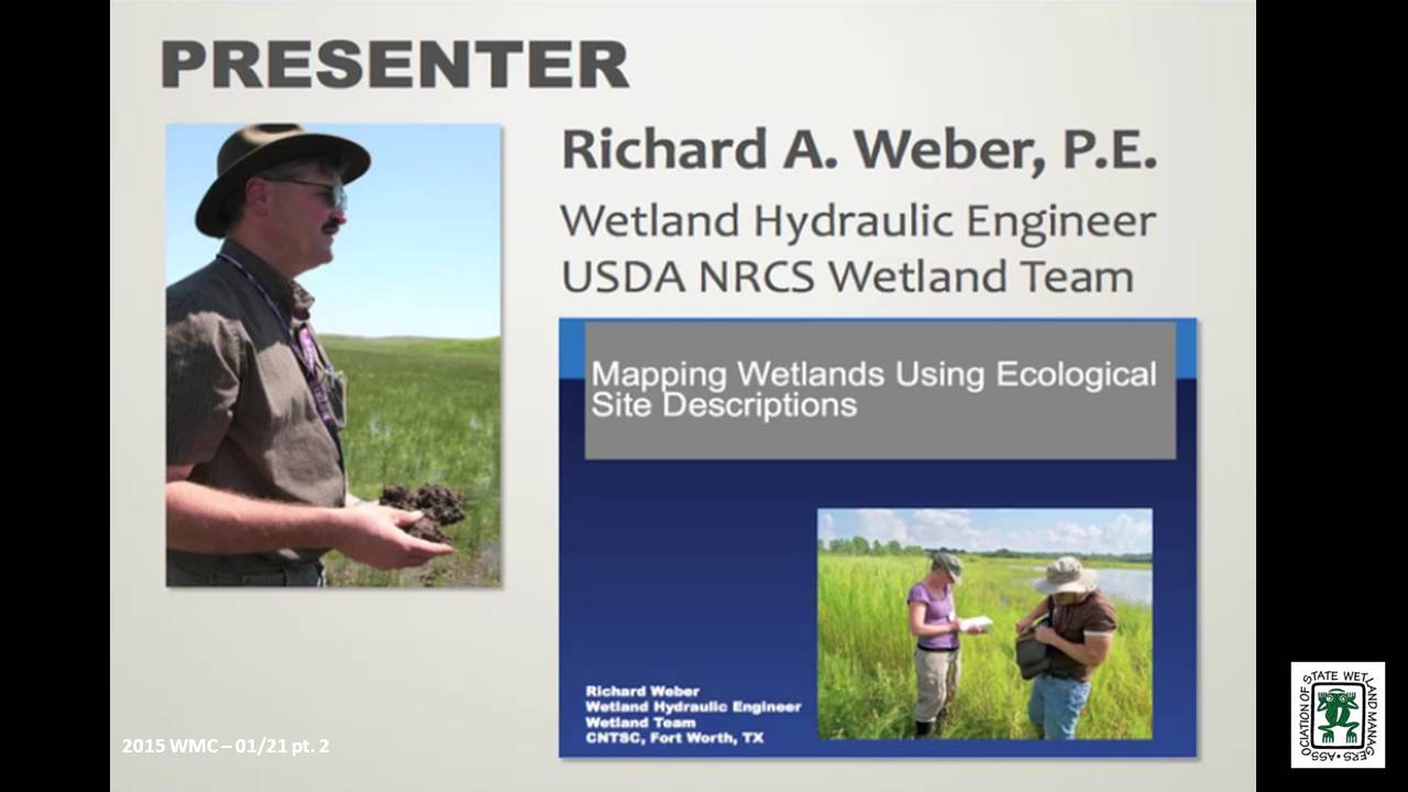
- Richard A. Weber, P.E., Wetland Hydraulic Engineer, NRCS [PRESENTATION PDF]
ABSTRACT
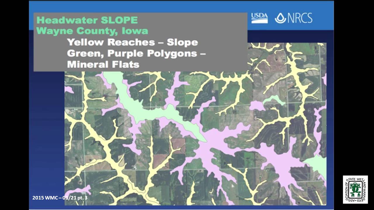
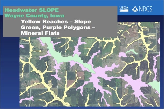
Mapping wetlands can be accomplished in many ways, depending on the needs, the data used, and some key assumptions. One need is for maps that define wetlands based on differencse in function. Ecological Site Description (ESD) development is an ongoing effort conducted by the Natural Resources Conservation Service, the U.S. Forest Service, and the Bureau of Land Management. ESDs are land unit concepts that define sites based on their ability to support common plant communities that respond similarly to management and stressors. Since the effort encompasses all landscapes, by definition wetland areas are included. The mapping of wetland ecological sites can be accomplished best by incorporating the principles of the Hydrogeomorphic (HGM) system. The result is a landscape concept which can be spatially defined, which has common hydrologic processes, landform, plant community, and function. Furthermore we present landscapes as individual elements in a watershed. The data sources used are the Soil Survey Geographic (SSURGO) database and Digital Elevation Data. This data provides the means to produce maps on a GIS platform using both ESD and HGM principles to produce mappable sites that fit jointly within the ESD and HGM framework.
BIO
 Richard A. Weber is a Wetland Hydraulic Engineer with the USDA Natural Resources Conservation Service (NRCS), Wetland Team, CNTSC in Fort Worth, Texas from 2006 to present. In this role, Rich has provided national leadership on wetland hydrology, including: Support for Wetland Restoration Program, Wetland Protection Policy, and E.O. 11990 Wetland Assessments. He leads a national training cadre for Wetland Restoration and Enhancement and Hydrology Tools for Wetland Determination courses. From 2005-2006, Rich was Design Engineer at the NRCS Nebraska State Office where he had design and A&E Contracting responsibilities for PL-566, WRP, and EQIP programs. From 1999-2005, he was a Field Engineer at the NRCS in the Scottsbluff, NE Field Office where he had design, construction, and contracting responsibilities for the Wetland Reserve Program, EQIP Irrigation and Animal Waste Management, and CTA conservation practices. From 1997-1999, Rich was an Agricultural Engineer at the NRCS in Chehalis, WA where he had design, construction, and contracting responsibilities for Conservation District funded Stream Restoration and Fish Passage projects, and EQIP program Animal Waste Projects. And from 1986-1997, he was a Watershed Project Engineer at the NRCS in Horton, KS where he performed Construction Contract Administration for PL-566 Watershed Protection and Flood Prevention projects.
Please click only once on each video recording to view in this window. Part 1: Introduction: Marla Stelk, Policy Analyst, Association of State Wetland Managers![]()
Presenter: Richard A. Weber, P.E., Wetland Hydraulic Engineer, NRCS![]()
![]()
![]()
![]()
![]()
View Past Wetland Mapping Consortium Webinars
PDF List of Past Wetland Mapping Consortium Webinar Recordings
View Upcoming Wetland Mapping Consortium Webinars