In Preparation for Next-Generation Wetland Mapping and Monitoring with NISAR
Held Wednesday, June 10, 2026 - 3:00 p.m. - 4:00 p.m.
INTRODUCTION
- Ian Grosfelt, National Association of Wetland Managers [PRESENTATION PDF]
PRESENTER
Laura Bourgeau-Chavez, Michigan Technological University [PRESENTATION PDF]
ABSTRACT
The recently launched NASA-ISRO (Indian Space Research Organization) NISAR mission provides unprecedented opportunities for systematic wetland monitoring through 6-12 day repeat coverage (with ascending and descending modes). NISAR collects dual-frequency L-band synthetic aperture radar (SAR) observations globally and quadrature polarization over select areas, including the midwestern US (much of the Great Lakes). This presentation highlighted the added capability of NISAR for global wetland mapping and monitoring. Imagery from the new satellite was shown, but the big release of data will not be until July 2026. Therefore, recent wetland research using the airborne version of NISAR, L- and S-band ASAR, acquired over Great Lakes coastal wetlands was presented. In this research we assessed multi-frequency polarimetric data from ASAR’s L- and S-bands as well as C-band from Radarsat-2. Using these quadrature polarized data, we demonstrated the capabilities and limitations of each wavelength for mapping wetland inundation beneath varying vegetation structures and biomass conditions. Comparisons among frequencies show differing sensitivities to flooded vegetation, canopy structure, and scattering mechanisms, improving our understanding of how wavelength and polarization influence inundation detection in complex wetland environments. For this often cloud covered region, we also assessed wetland type mapping using the single date of fully polarimetric L- and S-band ASAR data, and high classification accuracies were achieved across diverse wetland classes. In addition, we evalutated SAR retrieval algorithms for wetland vegetation biomass. The longer wavelength of L-band provides greater vegetation penetration capability to detect inundation and estimate biomass, thus it is highly complementary to both C-band (e.g. Sentinel-1) and optical-IR data (e.g. Sentinel-2 and Landsat) for monitoring wetlands.
BIO
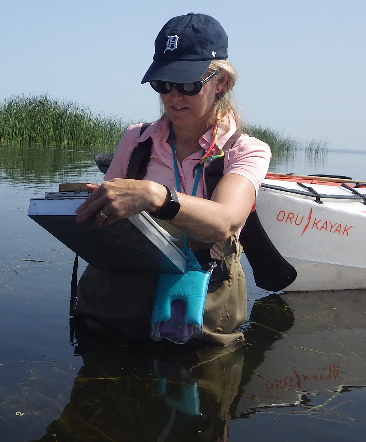 Laura Bourgeau-Chavez, PhD is Chief Research Scientist and Sensing the Natural Environment Practice Area Lead at Michigan Tech Research Institute. She is Adjunct Associate Professor in Michigan Technological University’s College of Forest Resources and Environmental Sciences. Laura has extensive experience in ecological research and remote sensing with a focus on wetlands and Synthetic Aperture Radar (SAR). She uses SAR alone or with other sensors to detect cryptic vernal pools, map wetland ecosystem types and to monitor inundation and soil moisture patterns. Her team has mapped wetlands across regions from the tropics to the boreal-arctic, including mountain peatland systems. Her research has had a strong focus on the Great Lakes coastal wetlands as well as boreal peatlands. Laura is particularly passionate about peatlands, which she has been researching for over twenty years and in 2021 she served as a coordinating lead author for the United Nations' Global Peatland Assessment. Bourgeau-Chavez holds a Bachelors of Science and Masters of Science from the University of Michigan in Natural Resources and Forest Ecology, respectively, and a PhD in Forest Ecology and Remote Sensing from the University of New Brunswick, Fredericton, N.B. Her dissertation was on using synthetic aperture radar satellite data to monitor fuel moisture in boreal ecosystems for fire danger assessment. As an adjunct associate professor at Michigan Tech, Bourgeau-Chavez serves on PhD and MS committees and gives occasional lectures on remote sensing of wetlands.
Introduction: Ian Grosfelt, National Association of Wetland Managers;
Please click only once on the video recording to view in this window. ![]()
Presenter: Laura Bourgeau-Chavez, Michigan Technological University

Understanding the Wetland Data Ecosystem: Different Approaches and Outcomes
Held Thursday, April 9, 2026 - 3:00 p.m.-4:30 p.m. EDT
INTRODUCTION
- Ian Grosfelt, National Association of Wetland Managers [PRESENTATION PDF]
PRESENTERS
- Megan Lang, U.S. Fish and Wildlife Service National Wetlands Inventory [PRESENTATION PDF]
- Andy Robertson, St. Mary's University of Minnesota GeoSpatial Services [PRESENTATION PDF]
- Robb MacLeod, Ducks Unlimited [PRESENTATION PDF]
- Meghan Halabisky, University of Washington
ABSTRACT
Understanding the Wetland Data Ecosystem: Different Approaches and Outcomes
Wetland geospatial data are increasingly important in light of current and future challenges around water quality, natural disaster mitigation, food and water security, conservation planning, and more. A wide-array of geospatial products can be used to support decision-making around wetlands –– from those that highlight where wetlands might be to those that identify specific wetland types and boundaries. These products are created for distinct geographies using varying wetland definitions and approaches. As a result, they map different areas and have contrasting levels of detail and accuracy. Through four unique perspectives, this webinar outlines the basic differences and relationships between wetland geospatial datasets, highlighting how they can be leveraged to best address user requirements.
BIOS
 Megan Lang is Chief Scientist for the U.S. Fish and Wildlife Service National Wetlands Inventory Program and Project Lead for the Wetlands Status and Trends study. She is an Adjunct Professor at the University of Maryland Department of Geographical Sciences and serves as an Associate Editor for the journal Wetlands. Dr. Lang has been working to improve the assessment of aquatic ecosystems through field and remote sensing studies for over two decades. Before working for the U.S. Fish and Wildlife Service, she led the U.S. Department of Agricultural Mid-Atlantic Regional Wetland Conservation Effects Assessment Project
 Robb Macleod is the National GIS Coordinator for Ducks Unlimited. He has been working for Ducks Unlimited in the GIS and Remote Sensing field for over 25 years. His current duties include coordinating all of the geospatial activities for Ducks Unlimited. Robb has been active in mapping wetlands in the Great Lakes for over 19 years with previous experience mapping wetlands and land cover in Alaska.
 Andy Robertson is currently Executive Director of GeoSpatial Services at Saint Mary’s University of Minnesota. In this role, Andy is responsible for oversight and management of all GeoSpatial Services projects, activities and staff. GeoSpatial Services is engaged in a wide variety of projects across the Lower 48 and Alaska including: Catholic Church properties data driven decision support, wetland inventory and functional assessment, national hydrography dataset updates; stakeholder consultation; and natural resource condition assessments. Andy has been a key partner of the USFWS, working for over 20 years to update legacy National Wetland Inventory data across the nation. He earned a Forest Technology Diploma from Sault College of Applied Technology in Ontario, Canada, a B.Sc. in Environmental Science from the University of Waterloo and completed postgraduate work in forest management at the University of Toronto. He is a board member for the National Association of Wetland Managers, steering committee member for the NAWM Wetland Mapping Consortium, Member of the American Rivers Functioning Floodplain Alliance, President-Elect of the Society of Wetland Scientists North Central Chapter and past chair of the Alaska Wetlands Technical Working Group.
 Meghan Halabisky is a co-founder of TealWaters and a Research Scientist at the University of Washington, specializing in remote sensing and geospatial analysis for wetland conservation. She holds a PhD in Remote Sensing and Geospatial Analysis from the University of Washington, where her research focuses on understanding wetland dynamics in the face of climate change and enhancing conservation strategies through cutting-edge spatial tools. She leads the NASA Carbon Monitoring System Science Team WetCarbon working group and serves as a Senior Science Advisor for Digital Earth Africa, working to support countries to develop national wetland inventories. Dr. Halabisky works closely with tribal governments, policymakers, and natural resource managers to promote equitable, nature-based solutions.
Please click only once on the video recording to view in this window.
Introduction: Ian Grosfelt, National Association of Wetland Managers;
Presenters: Megan Lang, U.S. Fish and Wildlife Service National Wetlands Inventory; Andy Robertson, St. Mary's University of Minnesota GeoSpatial Services; Robb MacLeod, Ducks Unlimited; and Megha Halabisky, University of Washington
View Past Wetland Mapping Consortium Webinars
PDF List of Past Wetland Mapping Consortium Webinar Recordings
View Upcoming Wetland Mapping Consortium Webinars