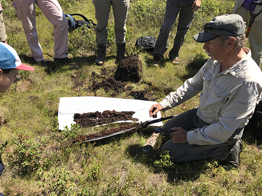
All wetlands exist on a substrate of soil, and most have water sources that are affected by movement through adjacent soils.  The movement of water through the soil medium, the ability of the soil to store surface and/or groundwater, and the ability of the soil to perform bio-geochemical processes is critical to wetland function.  In a large sense, differences in wetland types correlate to differences in soil types.  For instance, the presence of an intact perching layer may preclude the ability of a particular wetland to store ground water but allow for greater surface water storage.  In many cases, a lack of understanding of soil hydrodynamics leads to unexpected outcomes.  

Failure to fully assess and plan for soils (avoiding compaction, identifying the need for soil amendments, detecting deep impervious or pervious layers) can also lead to poor outcomes. While desktop screening for hydric soils, or soils with hydric inclusions, is a necessary first step, typically actual sampling including test pits should be conducted to better assess site suitability for wetland restoration and identify potential risks. Excessive excavation and grading activities can significantly disrupt soil profiles. Soil type, treatment, and condition can be a big determinant of success or failure.  This can render the top soil layer deficient in organic matter and nutrients that are essential to establishing a healthy plant community. Large scale disturbance to the soil also facilitates the establishment of invasive species and can result in a monoculture of undesirable vegetation.

In some locations, soils also need to be evaluated for the presence of toxics and/or pesticides and risks need to be carefully evaluated.  For example, the restoration of pre-existing marshland around Lake Apopka in Florida in the late nineties resulted in a massive bird die-off. When the land was purchased, it was known that it included an unknown quantity of old pesticides that might pose a risk to wildlife. Twenty thousand tons of contaminated soils were removed. However, the environmental risk assessment indicated that some pesticides still remained, including DDT and its metabolites, which were of concern to piscivorous birds. The old farm fields in the North Shore were flooded anyway and the subsequent arrival of birds was seen as a “success.” More than 1,000 birds perished, not including the subsequent deaths after migration and due to reproductive damages. The birds were poisoned when they ate fish on former farmlands north of Lake Apopka that had been flooded with lake water. (Industrial Economics, 2004).  

National Association of Wetland Managers Soils Training Webinar Series

The National Association of Wetland Managers is launching a series of training webinars on hydric soils for wetland professionals and more specifically state and tribal wetland field staff (plus state/tribal wetland managers, local municipal officials, conservation commissions, boards of health and others).  

This four-part training series is for wetland field practitioners who need expertise in hydric soils and seek to understand how hydric soils are formed and how to recognize and interpret the information they provide when observed in the field.  This can also be used as refresher course for those practitioners who have not had soils training in recent years.  

This soils training webinar series is being developed as part of an EPA Wetland Program Development Grant-funded project to develop and deliver high quality wetland training to on-the-ground wetland professionals.  

Each webinar in this soils training series will be accompanied by a short quiz at the end to assess whether participants understand the key take-away points of the training.  While taking the quiz is voluntary, to receive CEUs for this course (for this soils training webinar series only), participants must complete the assessment quiz.  Regardless of whether you seek CEU documentation or not, we hope all participants will complete the quiz at the end of each webinar to help us assess the effectiveness of the presentations and the training session for our grant.

NAWM HYDRIC SOILS TRAINING SERIES WEBINARS [#1 - #2 - #3 - #4]

National Association of Wetland Managers Soils Training Webinar #1 of 4: Basics of Hydric Soils

July 13, 2016 3:00 pm Eastern

This first webinar in a monthly four-part series on hydric soils focused on four initial topics: soil formation, horizonation v. simple processes; soil texture and structure; and describing soil color.  This webinar is designed to 1) help wetland managers better understand hydric soils, 2) outline how to fill out the hydric soils data sheet and 3) provide guidance on how to interpret the data sheet.  

The next three NAWM hydric soils webinars (see schedule below) will continue to build participants’ knowledge of hydric soils, covering hydric soils processes, landform and landscape and the use of field indicators. All webinars in this series will be recorded and available for viewing at a later date.

This first webinar provided three presentations followed by opportunity for questions and answers:

Introduction: Brenda Zollitsch, Policy Analyst, National Association of Wetland Managers and Jeanne Christie, Executive Director, National Association of Wetland Managers [POWERPOINT - INTRODUCTION]

PRESENTERS

Presentation #1: The Five factors of Soil Formation and Horizonation vs. Simple Processes - W. Lee Daniels, Virginia Tech [POWERPOINT PRESENTATION]

This presentation introduced the definition of hydric soils and describe the five factors of soil formation.  Horizonation will be compared to simple processes.  The presenter covered organic matter additions, leaching, illuviation, organic matter and other processes.

Presentation #2: Soil Texture and Structure - Ann M. Rossi, ORISE Research Fellow, U.S. Environmental Protection Agency [POWERPOINT PRESENTATION]

This presentation focused on two physical soil properties, texture and structure. Soil texture describes the relative proportions of sand, silt, and clay in a mineral soil. In soils where organic matter contents are high (such as hydric soils) organic textural classes or modifiers may be used to describe the soil texture instead. Soil structure describes the naturally occurring arrangement of soil particles into peds or aggregates. The combination of soil texture and structure influences how water is stored and moves through the soil, as well as other soil processes. This webinar covered how these properties are characterized as well as how they influence hydric soil processes.

Presentation #3: Describing Soil Color for Hydric Soils Determination - Lenore Vasilas, USDA Natural Resources Conservation Service [POWERPOINT PRESENTATION]

This presentation focused on describing soil color.  Soil color and the color patterns in soil can tell you a lot about the soil. It is an especially good indicator of soil wetness and hydric soils. The primary components that give a soil its color are soil organic matter, iron, and the color of soil particles. The Munsell Soil Color System is the standard we use to document soil color. When documenting soil color it is important to note matrix color, mottle colors, and type, location and abundance of mottles.

BIOS

W. Lee Daniels is the Thomas B. Hutcheson Professor of Environmental Soil Science at Virginia Tech in Blacksburg, Virginia. He received his Ph.D. in Soil Science from VPI & SU in 1985. Dr. Daniels areas of specialization include stabilization and restoration of disturbed lands including areas disturbed by mining, road building, waste disposal, urbanization and erosion. In particular, he has focused his research and consulting experience in wetland impact mitigation, mine reclamation, and soil-waste management systems. His teaching programs at Virginia Tech focus on soil geomorphology and landscape analysis with particular emphasis on the relationships among surficial geology, hydrology, soil patterns and long term landscape evolution processes. Major awards include the Reclamation Researcher of the Year by the American Society for Surface Mining and Reclamation (ASMR) in 1993, USEPA’s National Biosolids Utilization Research Award in 2000 and the Lifetime Achievement in Research Award by ASMR in 2012.

Annie Rossi is a soil scientist currently working within EPA’s Wetlands Division at EPA Headquarters in Washington, D.C., under an appointment to the Oak Ridge Institute of Science and Education (ORISE) Research Participation Program. She provides support to the National Wetland Condition Assessment, particularly in areas of hydric soils, field protocol development and training, and data analysis. She is also researching soil indicators that could be used to monitor and assess wetland condition and stress as part of the National Wetland Condition Assessment. Annie received her doctorate in Environmental Science and Technology from the University of Maryland. Her dissertation research focused on soil processes in wetlands on Mid-Atlantic barrier islands, including the development of Hydric Soil Field Indicators for use in the region.

Lenore Vasilas is a USDA Natural Resources Conservation Service (NRCS) soil scientist on the Soil Science Division Technical Soil Services Staff. She has been a soil scientist for NRCS for 28 years working for the first 7 years on soil survey and the rest of her career in various positions concentrating on hydric soils issues. She has been a member of the National Technical Committee for Hydric Soils for 20 years and is the current chair of the committee.

NAWM Hydric Soil Training Webinar #2: Hydric Soil Processes

Wednesday, August 10, 2016 – 3:00 pm Eastern

Introduction: Brenda Zollitsch, Policy Analyst, National Association of Wetland Managers and Jeanne Christie, Executive Director, National Association of Wetland Managers [POWERPOINT - INTRODUCTION]

PRESENTERS

  • John Galbraith, Associate Professor, Crop and Soil Environmental Sciences, Virginia Tech [POWERPOINT PRESENTATION]
  • Bruce Vasilas, Professor of Agronomy and Soil Management in the Plant and Soil Sciences Department at the University of Delaware [POWERPOINT PRESENTATION]
  • Lenore Vasilas, USDA Natural Resources Conservation Service (NRCS) soil scientist on the Soil Science Division Technical Soil Services Staff [POWERPOINT PRESENTATION]

Redox Reactions and Redoximorphic Features

The webinar began with a review of redox reactions and redoximorphic features. Reduction and concurrent oxidation (redox) are the dominant chemical processes taking place in wetland soils. There are abiological and biological driven redox reactions in wetland soils. We are most interested in the reactions driven by microbial breakdown of organic matter in soils under saturated conditions that lead to unique anaerobic conditions that meet the hydric soil definition of USDA. The redox reactions lead to mobilization of soluble Fe and Mn (depletion zones and surfaces) and subsequent reoxidation (concentration zones and surfaces), collectively called redoximorphic features. Redox feature types are identified through images. Description of the features is briefly reviewed, in preparation for use as components of field indicators of hydric soils.

Hydric Soils Functions

The second segment of the webinar focused on wetland functions attributed directly to hydric soils. Functions are the biological, chemical, and physical processes that occur in wetlands. Hydric soils play a direct role in the wetland functions of water retention (short term and long term), sedimentation, carbon sequestration and biogeochemical cycling of nutrients. Due to their capacity to become anaerobic close to the surface, hydric soils support unique plant communities and wildlife habitat unlikely to be found in uplands. Functional capacity is influenced by landscape position, hydrologic characteristics, and soil characteristics. Soil characteristics that affect wetland functions include porosity, permeability, drainage class/hydroperiod, organic matter content, slope, micro-topography, and chemical properties.

The Hydric Soil Technical Standard

The final presentation focused on the Hydric Soil Technical Standard.  The Hydric Soil Technical Standard (HSTS) provides a quantitative method of determining if a soil meets the definition of a hydric soil. The HSTS can be used to: 1) Identify a soils forming as hydric soils when a field indicator may not be present (e.g. wetland creation sites, problematic hydric soils); 2) Evaluate the current functional status of a hydric soil (e.g. change to hydrology); and 3) Propose changes to hydric soil indicators (e.g. expanding jurisdictional extent of an indicator, revising an existing indicator, adding a newly developed indicator). The HSTS requires quantitative measurements showing the soil becomes saturated and anaerobic in the upper part during normal precipitation years.

BIOS

John Galbraith, PhD, has been teaching about soils, agronomy, environmental science and wetlands since 1990 and coaches the soil judging team. He is also a Soil Information cooperative extension specialist. John received his B.S. and M.S. in Range and Wildlife Management at Texas Tech University. John received a Ph.D. in Soil Science at Cornell in 1997. In between, he worked for ten years as a USDA and university Soil Scientist in eight states, mapping ½ million acres of soil. He taught at Cornell and the University of Florida in 1998-99, then began working at Virginia Tech in 1999. John enjoys gleaning, sports, exercise, gardening, science, geology, and nature in general.

Bruce Vasilas, PhD, is a Professor of Agronomy and Soil Management in the Plant and Soil Sciences Department at the University of Delaware. His research focuses on hydric soils and wetlands ecology, identification, morphology and interpretation of hydric soils, water quality in wetlands, functional assessment of wetlands, monitoring of wetlands for hydrology and biogeochemical cycling, and other wetland and water related areas.  Bruce serves on the Mid-Atlantic Hydric Soils Committee, Soil Science Society of America, Society of Wetlands Scientists, and American Society of Agronomy. Bruce received his Ph.D.in Soil Microbiology from the University of Minnesota; and his M.S. in Soil Biochemistry from the University of Maryland.

Lenore Vasilas is a USDA Natural Resources Conservation Service (NRCS) soil scientist on the Soil Science Division Technical Soil Services Staff. She has been a soil scientist for NRCS for 28 years working for the first 7 years on soil survey and the rest of her career in various positions concentrating on hydric soils issues. She has been a member of the National Technical Committee for Hydric Soils for 20 years and is the current chair of the committee.


NAWM Soils Training Webinar #3: Landforms and Landscapes

Wednesday, September 14, 2016 – 3:00 pm Eastern

Introduction: Brenda Zollitsch, Policy Analyst, National Association of Wetland Managers and Jeanne Christie, Executive Director, National Association of Wetland Managers [POWERPOINT - INTRODUCTION]

PRESENTERS

This third webinar in NAWM’s four-part webinar training series on hydric soils addresses landforms and landscapes, focusing on three specific topics: 1) landscape and hydric soils, 2) problematic landscapes and parent materials, and 3) HGM and hydric soils.  

This webinar series has been designed for wetland field practitioners who need expertise in hydric soils, seek to understand how hydric soils are formed, and how to recognize and interpret the information they are provided from the field.  This can also be used as a refresher course for those practitioners who have not had soils training in recent years.  The series is being developed as part of an EPA Wetland Program Development Grant-funded project to develop and deliver high quality wetland training to on-the-ground wetland professionals.  

Each webinar in this soils training series will be accompanied by a short quiz at the end to assess whether participants understand the key take-away points of the training.  While taking the quiz is voluntary, to receive documentation of participation for use in obtaining CEUs for this course (for this soils training webinar series only), participants must complete the assessment quiz.  Regardless of whether you seek CEU documentation or not, we hope all participants will complete the quiz at the end of each webinar to help us assess the effectiveness of the presentations and the training session for our grant.

Please note: The webinars presented in this hydric soils series are being recorded and will be post-processed into individual online training modules of anytime/anywhere access.  The online modules will allow participants to complete the module and a quiz to receive documentation of participation which can be submitted to accrediting organizations for them to consider for use in obtaining CEUs.  The first modules will be available by the end of the calendar year and will be promoted via NAWM’s regular promotional channels and on NAWM’s webpage when they are available.

ABSTRACT

Landscapes and Hydric Soils: The first part of the webinar will focus on typical hydric soil morphologies associated with major wetland types-tidal marshes, peat bogs, perennially-inundated swamps, mineral soil flats, floodplains, depressions, and slope wetlands. The roles of landscape position, hydroperiod, and hydrodynamics on soil morphology will be emphasized. Soil morphology is impacted by the duration of inundation, and the seasonal vertical fluctuations in water tables. Water collecting surfaces such as closed depressions facilitate ponding; water shedding surfaces on slopes promote rapid movement of surface water through the wetland. Peat bogs are hydrologically isolated and permanently saturated; floodplains receive hydrologic inputs from overbank flow and groundwater discharge, and exhibit short-term inundation. Therefore, because of differences in landscape position and associated hydrologic characteristics different types of wetlands produce distinctive hydric soils.

Problematic Landscapes and Parent Materials: The second part of the webinar will focus on problematic landscapes and parent materials.  Most hydric soils exhibit certain common morphological characteristics that allow you to identify them as a soil that meets the hydric soil definition. Problem soils are hydric soils that do not exhibit these common hydric soil morphologies. The lack of a morphological indicator despite the soil developing anaerobic conditions in the upper part can be caused by many things including problematic parent material, certain environmental conditions, and the replenishment of iron oxides or new sediments in the upper part of the soil. For some problem soils, alternate morphologies that can only be used in specific problematic situations have been developed. For those problematic situations where an indicator has not been identified, alternative methods of identifying the soil as hydric must be employed. These techniques are outlined in chapter 5 of the Corps of Engineers Regional Supplements.

HGM and Hydric Soils: The third, and final, part of the webinar will focus on the Hydrogeomorphic (HGM) system and hydric soils. The classification of wetlands in the HGM system is based on landscape position, dominant water source, and hydrodynamics – the magnitude and direction of water inflow and outflow.  Information on these parameters is contained in soils information, which is housed in the Web Soil Survey and the soils database.  While HGM interpretations are not provided directly, knowledge of soils attributes can be readily applied to make HGM class and sub-class designations.  These attributes can be used to aggregate soil map units into HGM site concepts.  A site concept is valid when all map units have similar water budgets, are in the same watershed positon, and have the same water movement vectors.  The HGM system also requires the definition of a Reference Domain, within which HGM classifications are valid.  Since soil map unit concepts are generally consistent within a Major Land Resource Area, this boundary is the first selection for the Reference Domain.  Since landscape position is more meaningfully defined as watershed position, the HUC-12 watershed scale is useful for heads-up testing of map unit aggregations. And since map units often need to be either aggregated, or disaggregated into components, the use of Digital Elevation Data is useful for performing these “lumping” or “splitting” operations.  The final result should be a HGM sub-class with associated map units, or components, which can be mapped across the MLRA extent, and which is useful for land managers and conservation planners.  

BIOS

Bruce Vasilas, PhD, is a Professor of Agronomy and Soil Management in the Plant and Soil Sciences Department at the University of Delaware. His research focuses on hydric soils and wetlands ecology, identification, morphology and interpretation of hydric soils, water quality in wetlands, functional assessment of wetlands, monitoring of wetlands for hydrology and biogeochemical cycling, and other wetland and water related areas.  Bruce serves on the Mid-Atlantic Hydric Soils Committee, Soil Science Society of America, Society of Wetlands Scientists, and American Society of Agronomy. Bruce received his Ph.D.in Soil Microbiology from the University of Minnesota; and his M.S. in Soil Biochemistry from the University of Maryland.

Lenore Vasilas is a USDA Natural Resources Conservation Service (NRCS) soil scientist on the Soil Science Division Technical Soil Services Staff. She has been a soil scientist for NRCS for 28 years working for the first 7 years on soil survey and the rest of her career in various positions concentrating on hydric soils issues. She has been a member of the National Technical Committee for Hydric Soils for 20 years and is the current chair of the committee.

Richard Weber, P.E. is the Wetland Hydraulic Engineer on NRCS’s National Wetland Team, housed at Fort Worth, TX. He provides hydrology support for NRCS wetland restoration programs and wetland protection policy.  He also assists with the application of wetland functions to address water quality, floodplain management, and other resource concerns.  Prior to his appointment in Fort Worth, he worked in the field in Kansas, Washington, and Nebraska.  He holds a B.S. in Agricultural Engineering from Kansas State University, and is a licensed Professional Engineer in the state of Kansas.  


NAWM Soils Training Webinar #4: Using Field Observations of Soils Onsite in Decision Making

Wednesday, October 12, 2016 – 3:00 pm Eastern

Introduction: Brenda Zollitsch, Policy Analyst, National Association of Wetland Managers and Jeanne Christie, Executive Director, National Association of Wetland Managers [POWERPOINT - INTRODUCTION]

PRESENTERS

  • John Galbraith, Associate Professor, Crop and Soil Environmental Sciences, Virginia Tech [POWERPOINT PRESENTATION]
  • W. Lee Daniels, Professor of Environmental Soil Science, Virginia Tech [POWERPOINT PRESENTATION]
  • Bruce Vasilas, Professor of Agronomy and Soil Management in the Plant and Soil Sciences Department at the University of Delaware [POWERPOINT PRESENTATION]

ABSTRACT

This is the fourth webinar in NAWM’s four-part webinar training series on hydric soils.  The webinar addressed using field observations of soils onsite in decision making, focusing on three specific topics: 1) field indicators of hydric soils in the United States, 2) using soils for mitigation, voluntary restoration and creation, and 3) using field indicators to assess long-term hydrology.

This webinar series has been designed for wetland field practitioners who need expertise in hydric soils, seek to understand how hydric soils are formed, and how to recognize and interpret the information they are provided from the field.  This can also be used as a refresher course for those practitioners who have not had soils training in recent years.  The series is being developed as part of an EPA Wetland Program Development Grant-funded project to develop and deliver high quality wetland training to on-the-ground wetland professionals.  

Each webinar in this soils training series is accompanied by a short quiz at the end of the presentations to assess whether participants understand the key take-away points of the training.  While taking the quiz is voluntary, to receive documentation of participation for use in obtaining CEUs for this course (for this soils training webinar series only), participants must complete the assessment quiz.  Regardless of whether you seek CEU documentation or not, we hope all participants will complete the quiz at the end of each webinar to help us assess the effectiveness of the presentations and the training session for our grant.

Please note: The webinars presented in this hydric soils series are being recorded and will be post-processed into individual online training modules of anytime/anywhere access.  The online modules will allow participants to complete the module and a quiz to receive documentation of participation which can be submitted to accrediting organizations for them to consider for use in obtaining CEUs.  The first modules will be available by the end of the calendar year and will be promoted via NAWM’s regular promotional channels and on NAWM’s webpage when they are available.

BIOS

John Galbraith, PhD, has been teaching about soils, agronomy, environmental science and wetlands since 1990 and coaches the soil judging team. He is also a Soil Information cooperative extension specialist. John received his B.S. and M.S. in Range and Wildlife Management at Texas Tech University. John received a Ph.D. in Soil Science at Cornell in 1997. In between, he worked for ten years as a USDA and university Soil Scientist in eight states, mapping ½ million acres of soil. He taught at Cornell and the University of Florida in 1998-99, then began working at Virginia Tech in 1999. John enjoys gleaning, sports, exercise, gardening, science, geology, and nature in general.

W. Lee Daniels is the Thomas B. Hutcheson Professor of Environmental Soil Science at Virginia Tech in Blacksburg, Virginia. He received his Ph.D. in Soil Science from VPI & SU in 1985. Dr. Daniels areas of specialization include stabilization and restoration of disturbed lands including areas disturbed by mining, road building, waste disposal, urbanization and erosion. In particular, he has focused his research and consulting experience in wetland impact mitigation, mine reclamation, and soil-waste management systems. His teaching programs at Virginia Tech focus on soil geomorphology and landscape analysis with particular emphasis on the relationships among surficial geology, hydrology, soil patterns and long term landscape evolution processes. Major awards include the Reclamation Researcher of the Year by the American Society for Surface Mining and Reclamation (ASMR) in 1993, USEPA’s National Biosolids Utilization Research Award in 2000 and the Lifetime Achievement in Research Award by ASMR in 2012.

Bruce Vasilas, PhD, is a Professor of Agronomy and Soil Management in the Plant and Soil Sciences Department at the University of Delaware. His research focuses on hydric soils and wetlands ecology, identification, morphology and interpretation of hydric soils, water quality in wetlands, functional assessment of wetlands, monitoring of wetlands for hydrology and biogeochemical cycling, and other wetland and water related areas.  Bruce serves on the Mid-Atlantic Hydric Soils Committee, Soil Science Society of America, Society of Wetlands Scientists, and American Society of Agronomy. Bruce received his Ph.D.in Soil Microbiology from the University of Minnesota; and his M.S. in Soil Biochemistry from the University of Maryland.


Useful Publications & Resources